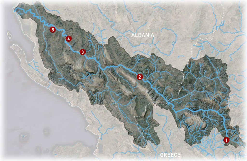
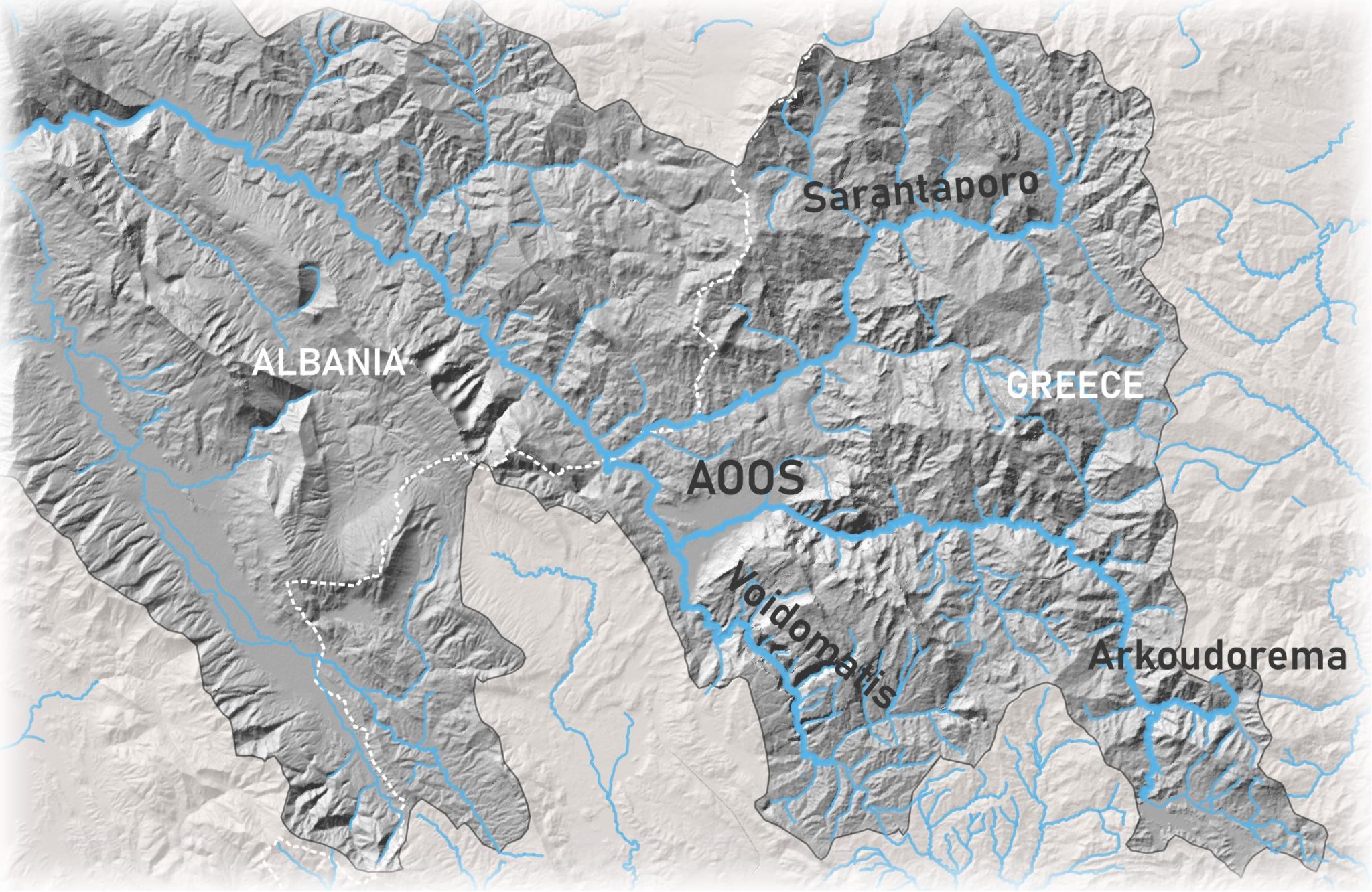
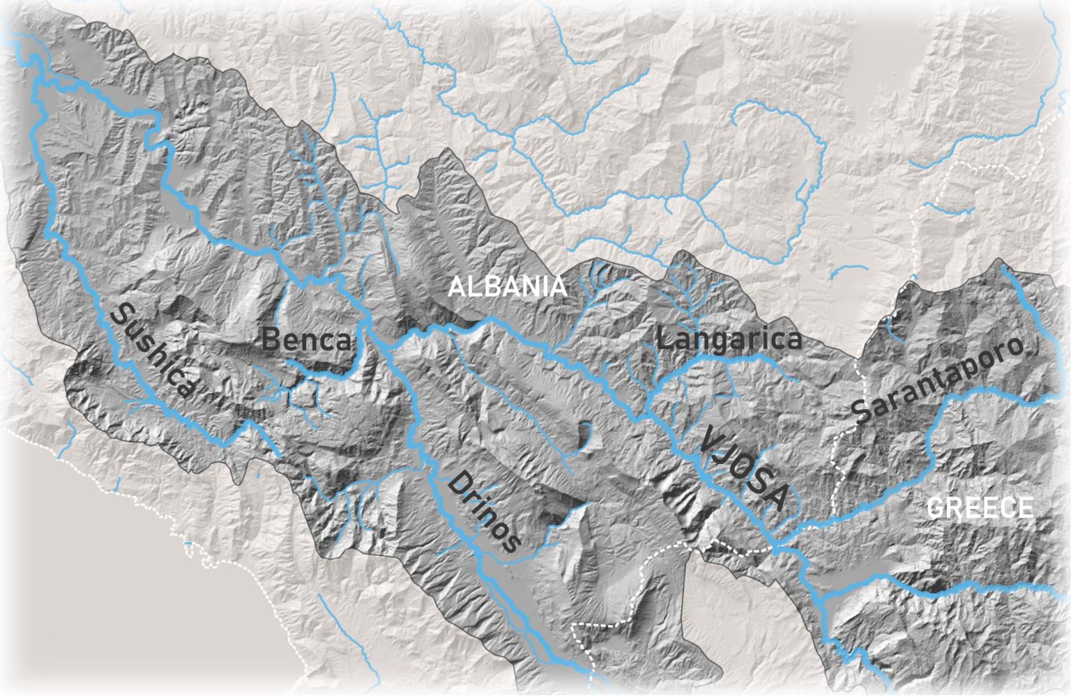
The Vjosa rises as the river Aoos at an altitude of 1235 metres near the village of Chrysovitsa on the Piges-Aoos plateau in northern Greece.
It flows in a north-westerly direction through the relatively mountainous terrain and forested slopes of the Northern Pindos Mountains.
It flows in a north-westerly direction through the relatively mountainous terrain and forested slopes of the Northern Pindos Mountains.
After 80 kilometres it traverses the small town of Konica and the Greek-Albanian border.
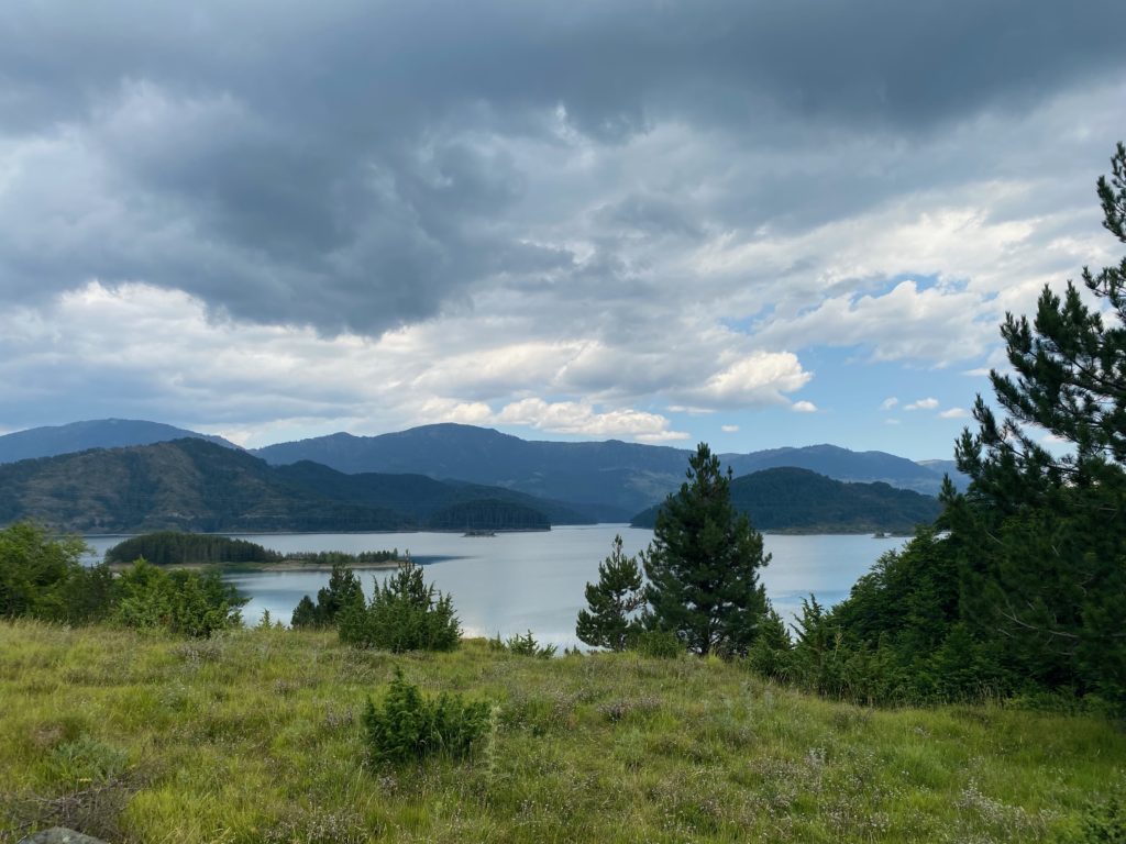
Although most of the river course flows through a protected area, officially declared a national park and known for its unique geology and geomorphology, the river is limited at its source by a hydroelectric power plant (with installed capacity of electricity production of 210 MW) built between 1985 and 1990.
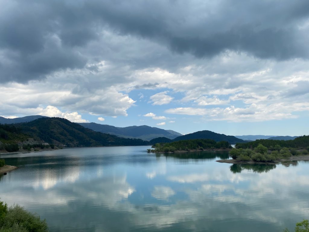
As a result, a 9 km² technical lake was formed, which covers a large part of the Piges-Aoos plateau.
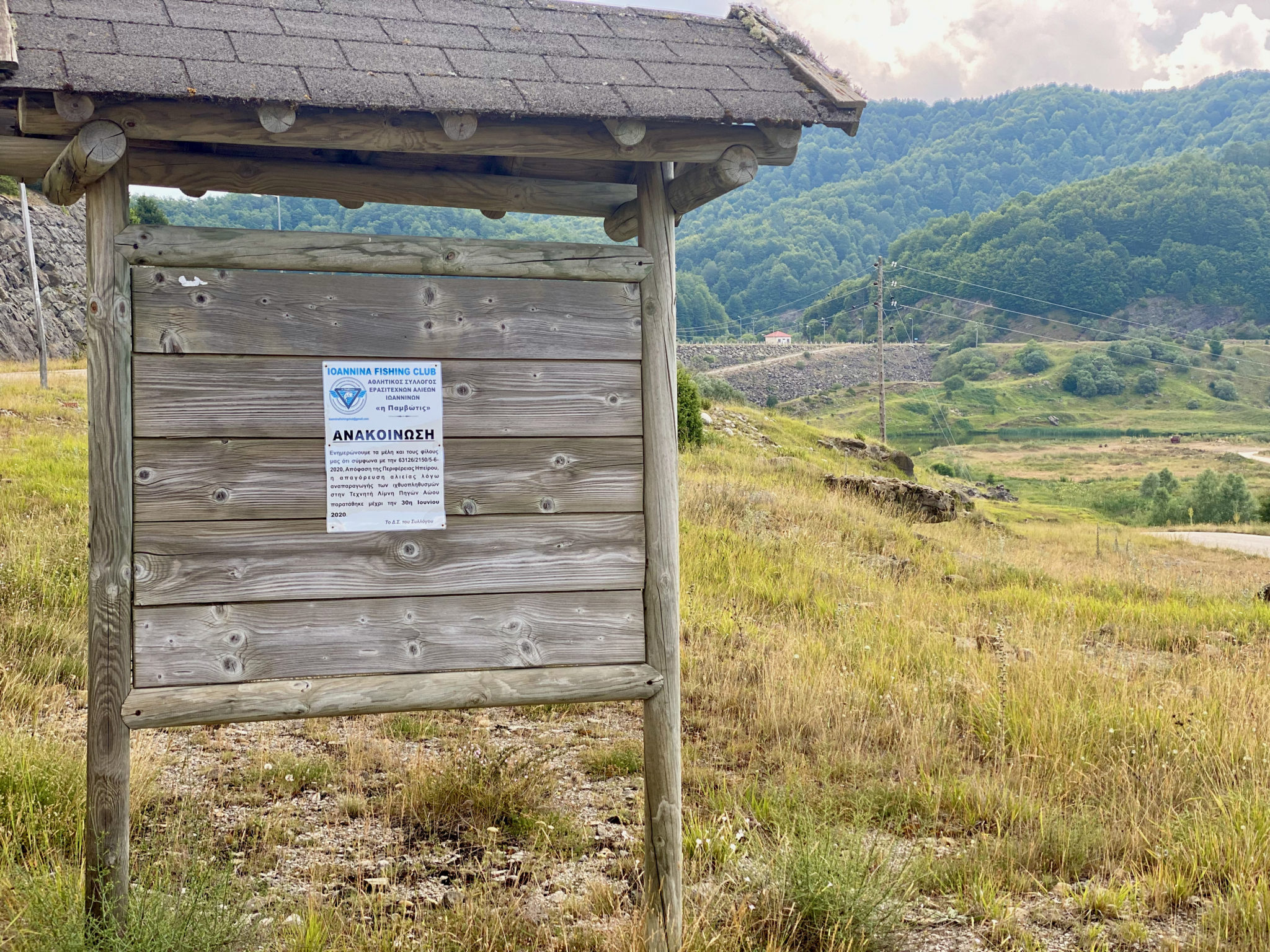
However, despite this major intervention in the river at its source, electricity production reportedly covers about 0.25% of the country’s total electricity production for the last four years (Katsulakos et al. 2019). The dam has gradually reduced the flow velocity of the river, increased the water temperature and impaired the aeration and oxygenation of the water.
Surrounded by mountain meadows and black pine and beech forests, this hydropower landscape is promoted as a potential place for hiking tourism, horseback riding and fishing.
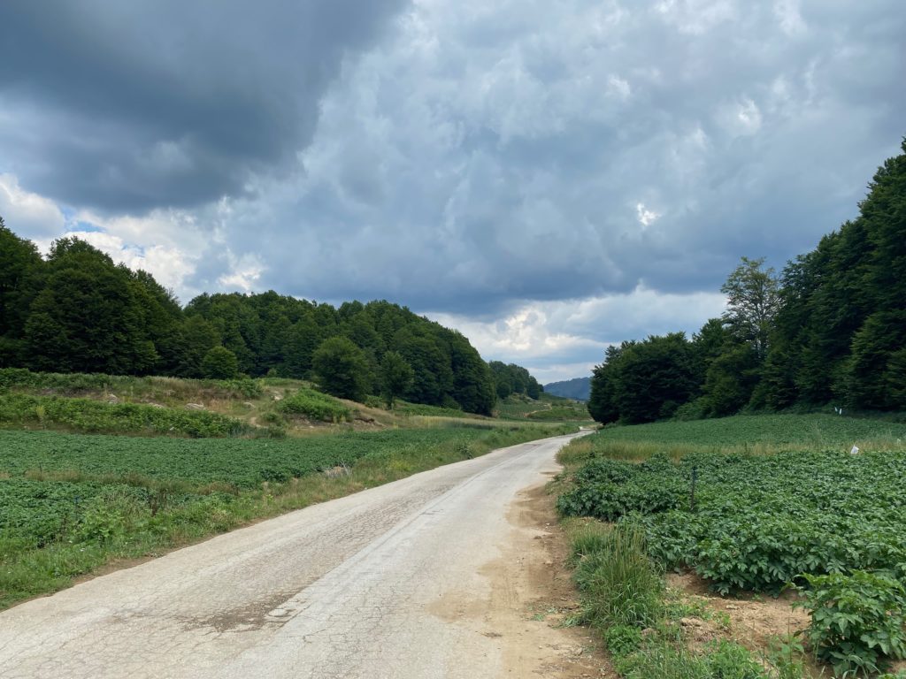
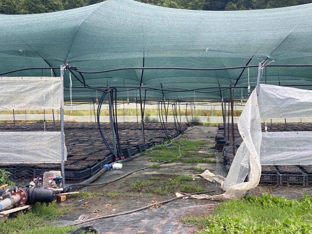
Yet this seemingly quiet area is not only promoted for hydro-tourism but also as a fertile place for agriculture with some agricultural entrepreneurs growing potatoes at an altitude of 1,100 metres.
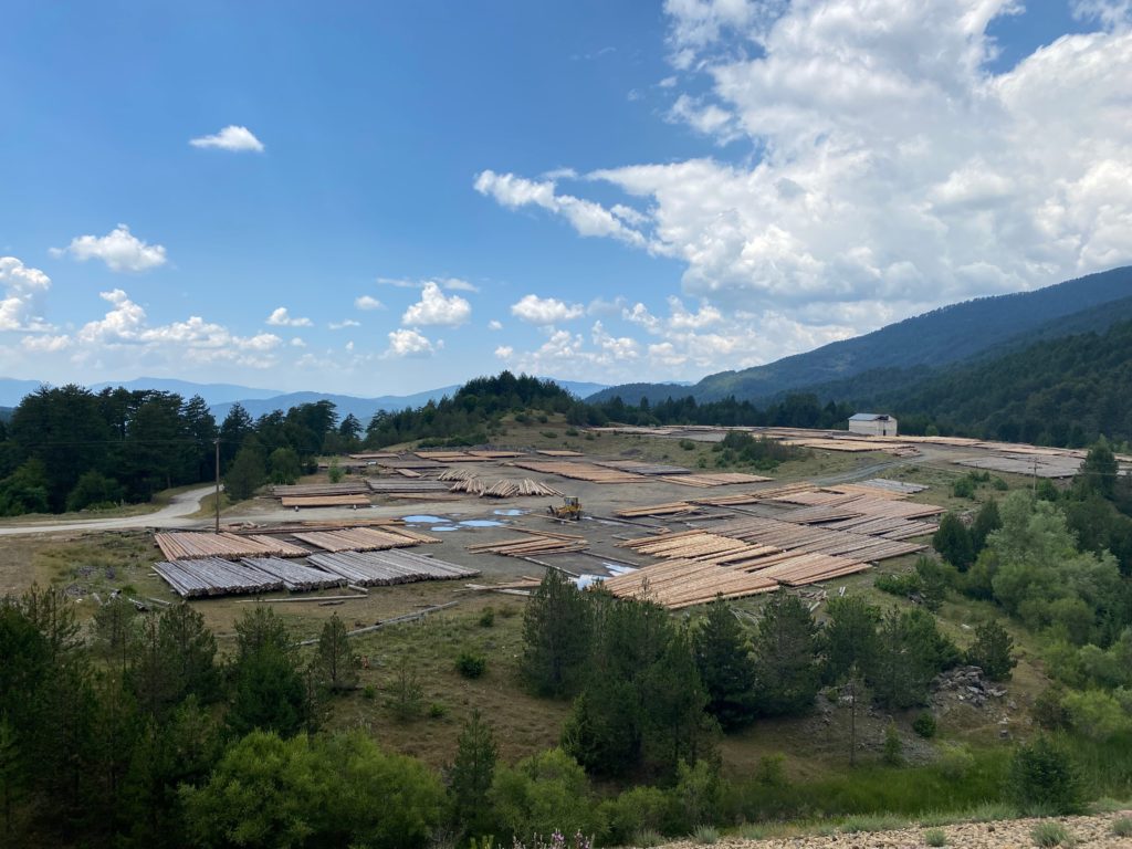
This forested area is also inviting to timber companies that are, along with the potato fields, turning the area into a large plantation that is gradually displacing the local ecosystem.
This forested area is also inviting to timber companies that are, along with the potato fields, turning the area into a large plantation that is gradually displacing the local ecosystem.
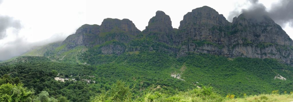
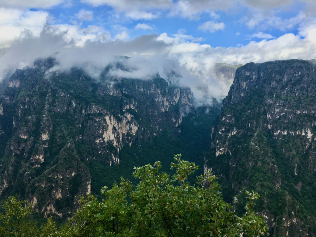
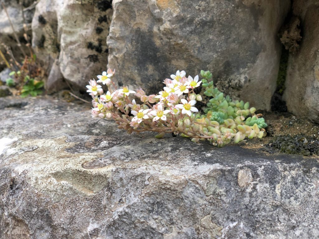
However, despite these interventions, the Aoos continues to flow through the Northern Pindos National Park, a protected area known for its unique geological and geomorphological value and home to more than 1,800 plant species and numerous animal species including mammals, birds, reptiles, amphibians and fish.
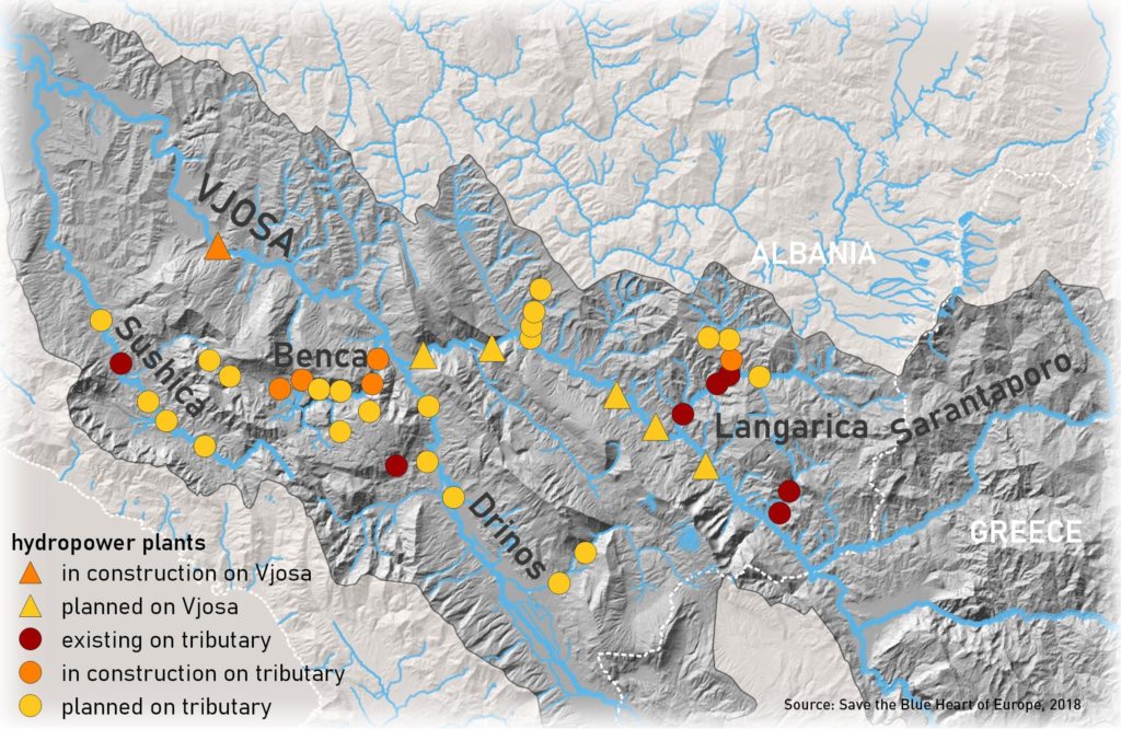
The Aoos River basin is characterised by three main tributaries: Voidomatis, Arkoudorema and Sarantaporo, a transboundary tributary.
After 80 kilometres the river crosses the Greek-Albanian border and enters Albanian territory as an already formed river called the Vjosa.
After 80 kilometres the river crosses the Greek-Albanian border and enters Albanian territory as an already formed river called the Vjosa.
Its surface is almost 16% of Albanian territory, and after 272 kilometres it reaches the Adriatic Sea.
Its surface is almost 16% of Albanian territory, and after 272 kilometres it reaches the Adriatic Sea.
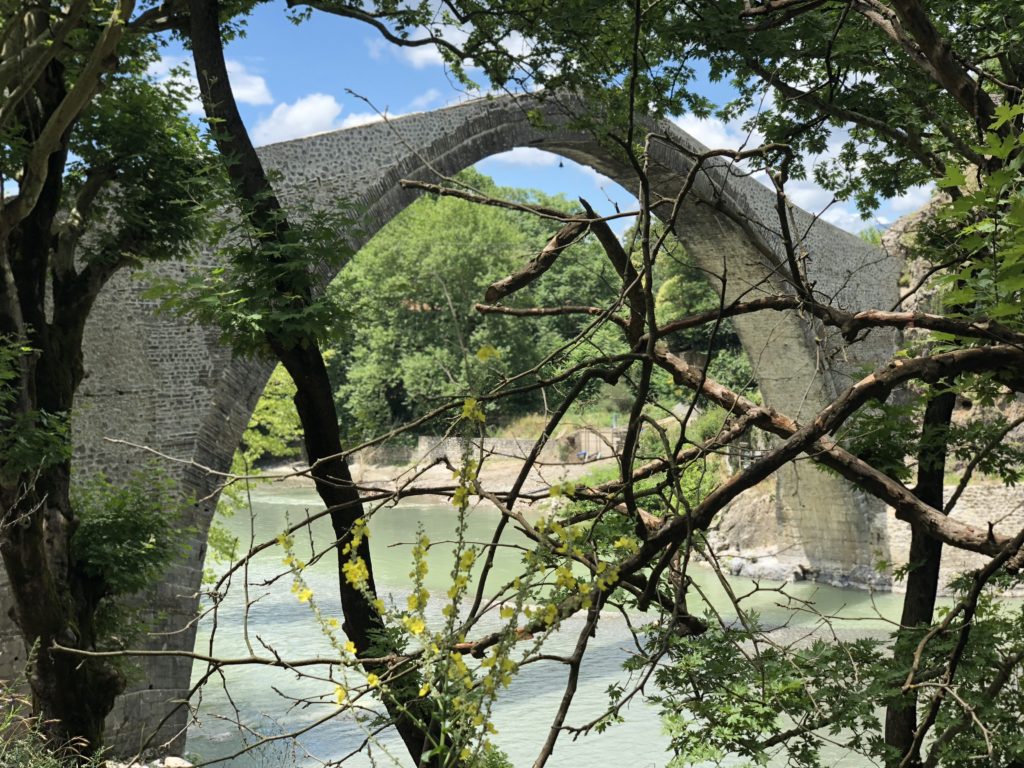
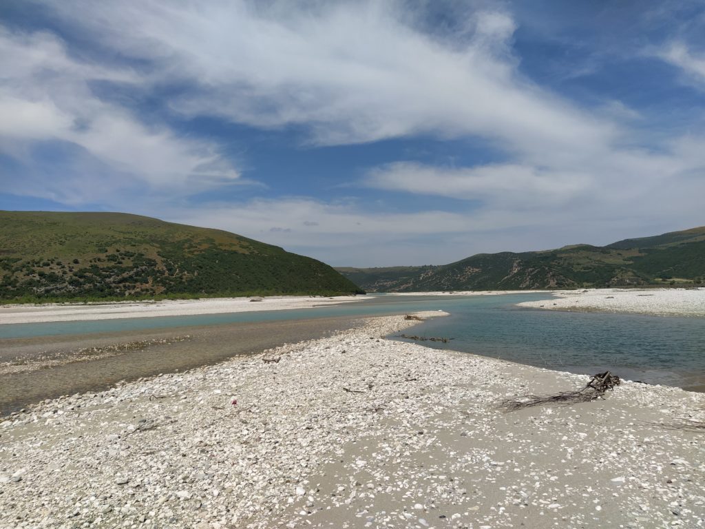
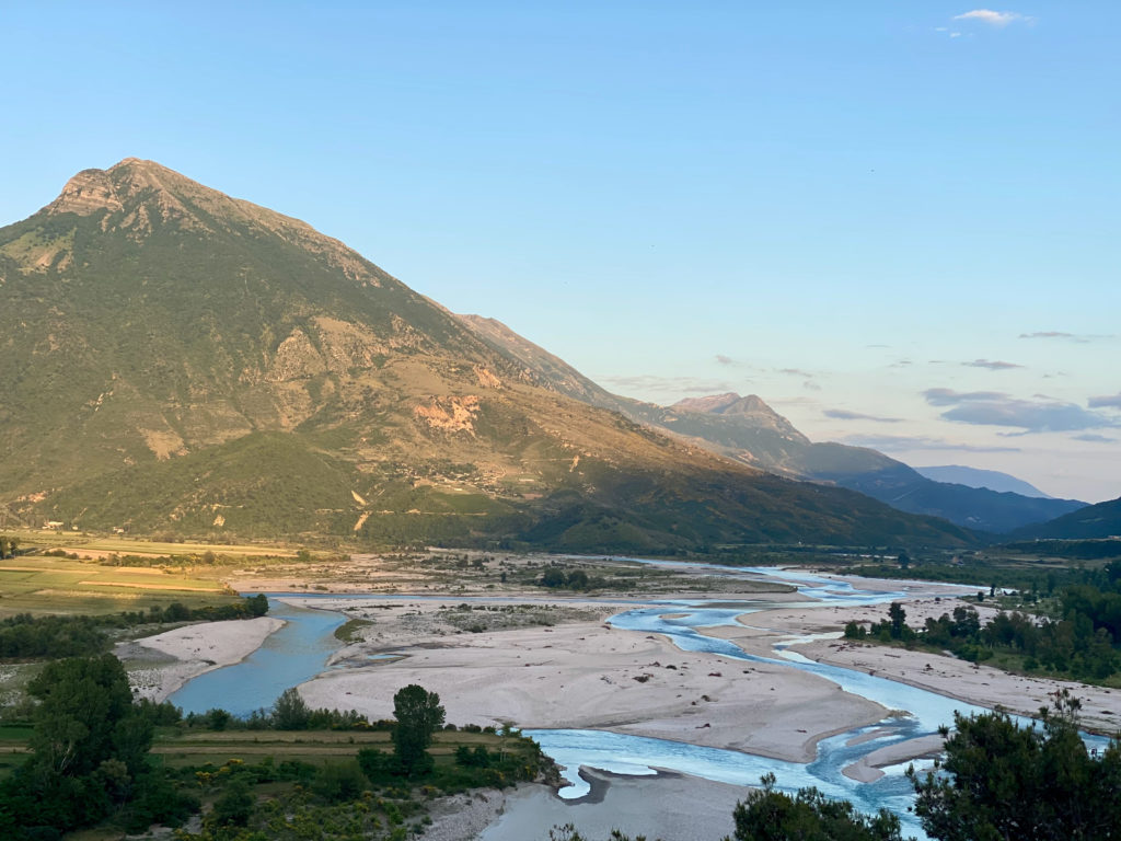
With the exception of the hydropower plant built on its upper catchment area in Greece, the Vjosa is considered one of the last “free-flowing rivers” in Europe, with one of the widest gravel bars. Its three main tributaries, the Sarandoporous, the Drinos and the Sushica, significantly contribute to its hydromorphological character.
The latter refers to high rates of sediment transport, which are important indicators of a river’s morphological activities and are crucial for maintaining river dynamics and proper functioning of the coastal and marine environment (Constantine et al. 2014; Sovinc 2021).
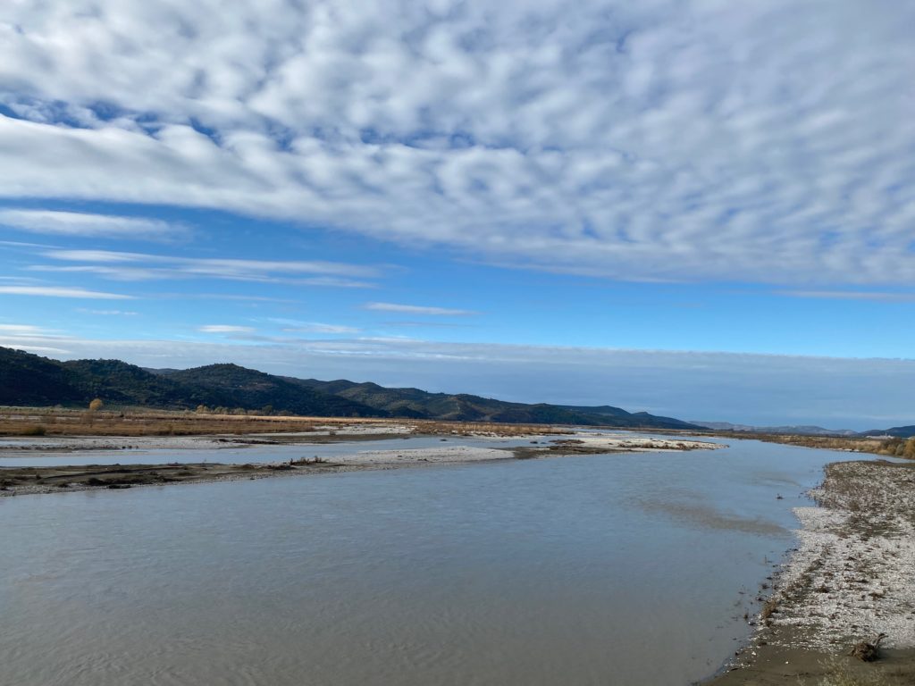
The middle section of the Vjosa – before and after the confluence with the Drinos – is characterised by sediment transport, causing the river to form wide gravel banks, among the widest in Europe, stretching about 2 kilometres in width near the village of Kuta.
The latter refers to high rates of sediment transport, which are important indicators of a river’s morphological activities and are crucial for maintaining river dynamics and proper functioning of the coastal and marine environment (Constantine et al. 2014; Sovinc 2021).
Thegravel barsare rich in vegetation, islands, side arms, oxbows, ponds and riparian forests, which provide breeding grounds for typical bird species.
The gravel bars are rich in vegetation, islands, side arms, oxbows, ponds and riparian forests, which provide breeding grounds for typical bird species.
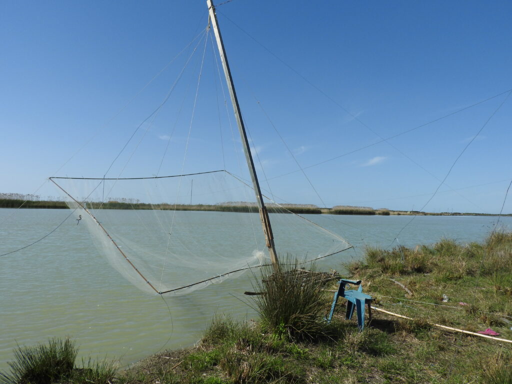
The riverine landscape of the Vjosa hosts a number of endangered species, including 13 globally threatened animal species and 2 vascular plants. About 117 species are listed in the Bern Convention.
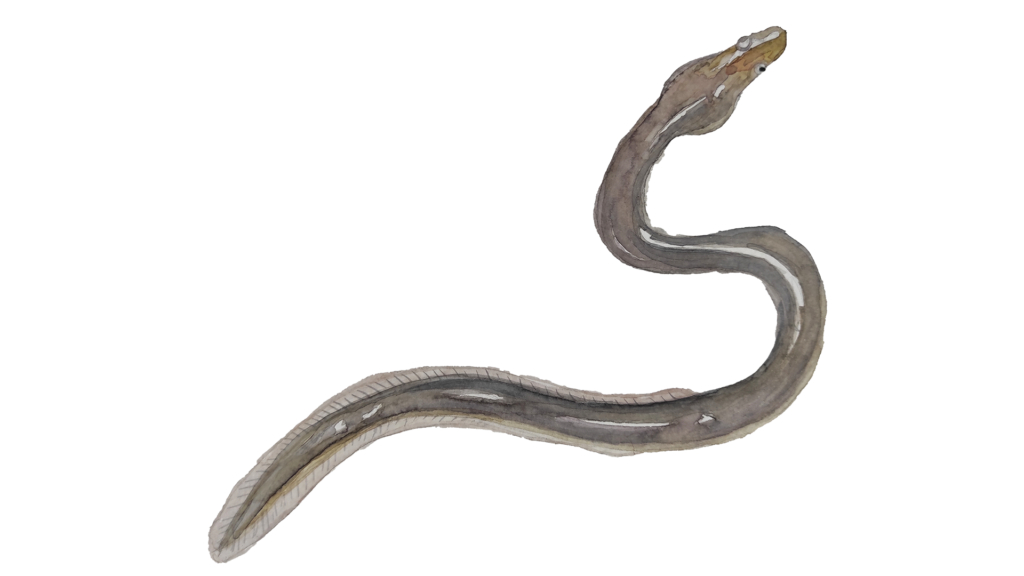
The entire river corridor
is important for migratory species such as the European Eel Aguilla Aguilla.
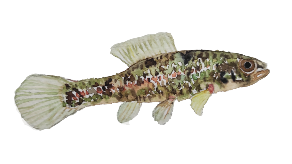
It is also home to two new species – a fish species, Pelasgus thesproticus (Meulenbroek et al. 2018),
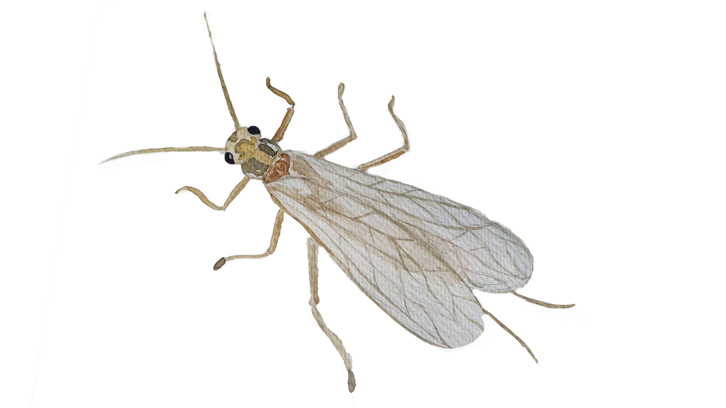
and Isoperla vjosae, larvae of the I. tripartita group (Graf, Pauls, Vitecek 2018).
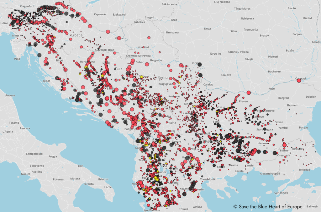
But this unique and rich river biohabitat has been threatened for many years by the construction of hydropower plants, which are still planned on a number of rivers in Albania, as well as in other parts of Southeast Europe, from Slovenia to Greece.
In the course of the gold rush on the rivers of Southeast Europe, transnational companies, in cooperation with local governments, had been planning for several years the construction of at least 42 hydropower plants on the Vjosa, 34 of which were to be built on its tributaries and 8 on its main course.
The power plant in Poçem is in the initial phase.
The power plant in Poçem is in the initial phase.
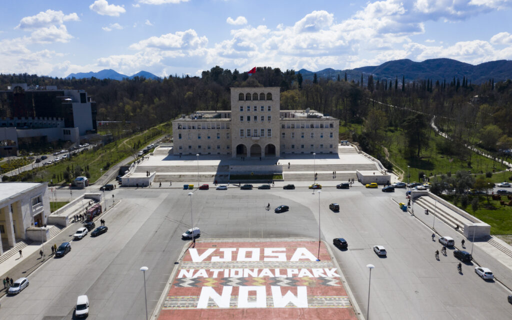
Due to decades of appeals by national and international scientists, environmentalists and non-governmental organisations such as EcoAlbania, RiverWatch, Euronatur and Balkan River Defence, warning of irreversible changes that would leave their mark on the environment and lead to the transformation of the entire ecosystem, and supported by the European Council, the construction of the two hydropower plants is currently halted. In 2020, the Albanian Ministry of Environment rejected the environmental impact assessment submitted by the Turkish-Albanian construction consortium. On June 13, 2022, the memorandum between Patagonia and the Ministry of Tourism and Environment (Albania) was signed to declare the Vjosa River a national park.
Due to decades of appeals by national and international scientists, environmentalists and non-governmental organisations such as EcoAlbania, RiverWatch, Euronatur and Balkan River Defencewarning of irreversible changes that would leave their mark on the environment and lead to the transformation of the entire ecosystem, and supported by the European Council, the construction of the two hydropower plants is currently halted. In 2020, the Albanian Ministry of Environment rejected the environmental impact assessment submitted by the Turkish-Albanian construction consortium. On June 13, 2022, the memorandum between the Ministry of Tourism and Environment (Albania) and outdoor company Patagonia was signed to declare the Vjosa River a national park.
For almost a decade, environmental activists and NGOs, together with scientists and locals, have campaigned for the Vjosa to be declared a national park.
Against this backdrop, RIVERINE ENVIRONMENTS takes you on a journey through the myriad changes and continuities affecting the Vjosa River over the course of two decades. It presents, maps and explains how various minor and major infrastructural and other anthropogenic interventions, as well as geophysical changes, have altered the river and how these changes are experienced and lived by the people inhabiting its riverine environment.
Using the case study of the Mura River, where the numerous power plants on the Austrian side of this transboundary river have caused the loss of sediments and the resulting deepening of the river on the Slovenian side, RIVERINE ENVIRONMENTS (the project started in 2019, when the Vjosa was still threatened by the construction of the HPP ) was meant to project how planned infrastructural interventions on the Vjosa could further change its river landscape.
References
– Constantine, J.A. et al. (2014) Sediment supply as a driver of river meandering and floodplain evolution in the Amazon Basin. Nature Geoscience 7(12), pp. 899–903. doi:10.1038/ngeo2282.
– Graf, W., S. U. Pauls, S. Vitecek. 2018. Isoperla vjosae sp. n., a new species of the Isoperla tripartita group from Albania (Plecoptera: Perlodidae). Zootaxa 4370(2), pp. 171–179. doi.org/10.11646/zootaxa.4370.2.5
– Meulenbroek P., S. Shumka, F. Schiemer. 2018. First reconnaissance of habitat partitioning and fish diversity in the alluvial zone of the river Vjosa, Albania. Acta ZooBot Austria 155, pp. 177–186
– Katsoulakos, N., L. Papada, T. Vrazitouli, G. Palamas. 2019. Study on Renewable Energy Sources in the Aoos basin – beyond hydropower exploitation. Report by Pindos Perivallontiki.
– Sovinc, A. (2021) Protection study of the Vjosa River Valley based on IUCN protected area standards. IUCN, p. 40. Available at: https://portals.iucn.org/library/node/49471 (Accessed: 6 September 2021).