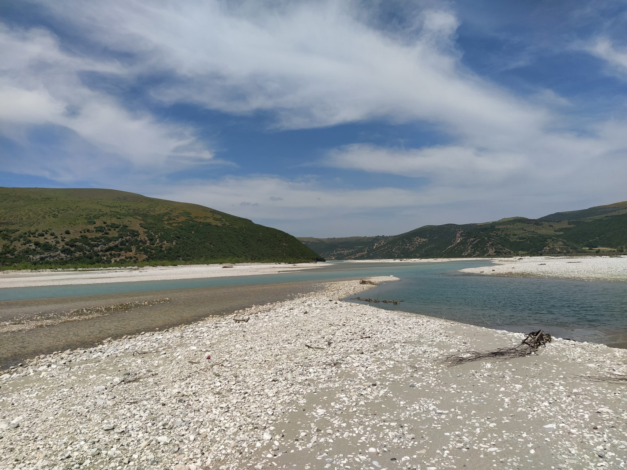
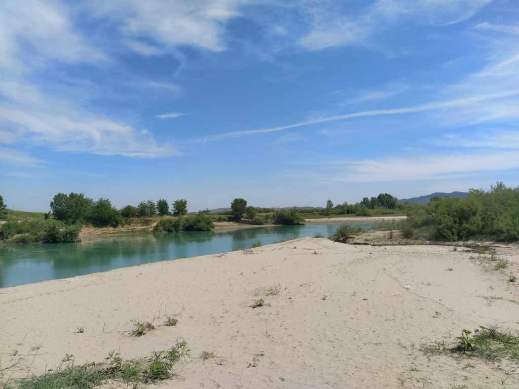
The Vjosa is known for its extensive gravel bars, which can reach several kilometres in width. Gravel bars are areas of sedimentation in rivers. When enough material accumulates in an area with reduced carrying capacity, it reaches above the water surface, forming geomorphological features known as gravel bars.
Gravel bars can become overgrown with vegetation and thus reach higher stability. However, we focus on bare gravel bars that are very dynamic. Their size and shape changes after events with high water level and large discharge.
Gravel bars can become overgrown with vegetation and thus reach higher stability. However, we focus on bare gravel bars that are very dynamic. Their size and shape changes after events with high water level and large discharge.
Due to their dynamic and responsive characteristics, gravel bars can be seen as indicators of changes in the riverine environment. They also play a role in numerous ecological functions and provide habitats for a wide range of plants and animals.
Due to their dynamic and responsive characteristics, gravel bars can be seen as indicators of changes in the riverine environment. They also play a role in numerous ecological functions and provide habitats for a wide range of plants and animals.
Gravel bars play a role in water filtration, the infiltration of water into ground water, the mitigation of river bank erosion and accessibility to the river. The main factors that threaten the existence of gravel bars are the removal of material through in-channel excavation and a break in sediment supply due to dams in the river.
Gravel bars play a role in water filtration, the infiltration of water into ground water, the mitigation of river bank erosion and accessibility to the river. The main factors that threaten the existence of gravel bars are the removal of material through in-channel excavation and a break in sediment supply due to dams in the river.
The Vjosa gravel bars are very special features with a broad significance. The planned hydro-power plants could alter them completely.
The Vjosa gravel bars are very special features with broad significance. Any kind of severe infrastructural intervention (such as the construction of hydropower plants, which was planned for a decade but has now been stopped due to the memorandum) could alter them completely.
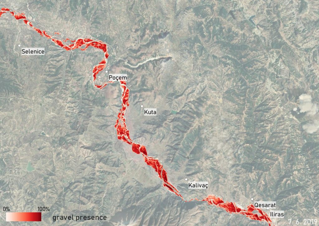
Monitoring is essential for the conservation of rich ecosystems such as gravel bars. The latter is often done through field mapping, which is time-consuming and very difficult in remote, inaccessible areas. To overcome these issues we have used earth observation with the analysis of satellite images.
To validate results based on satellite images we compared them to data from river gauging stations. On the Vjosa, we found a very high correlation between the surface area of water detected on satellite images, and the water level measured at the gauging station in Dorez.