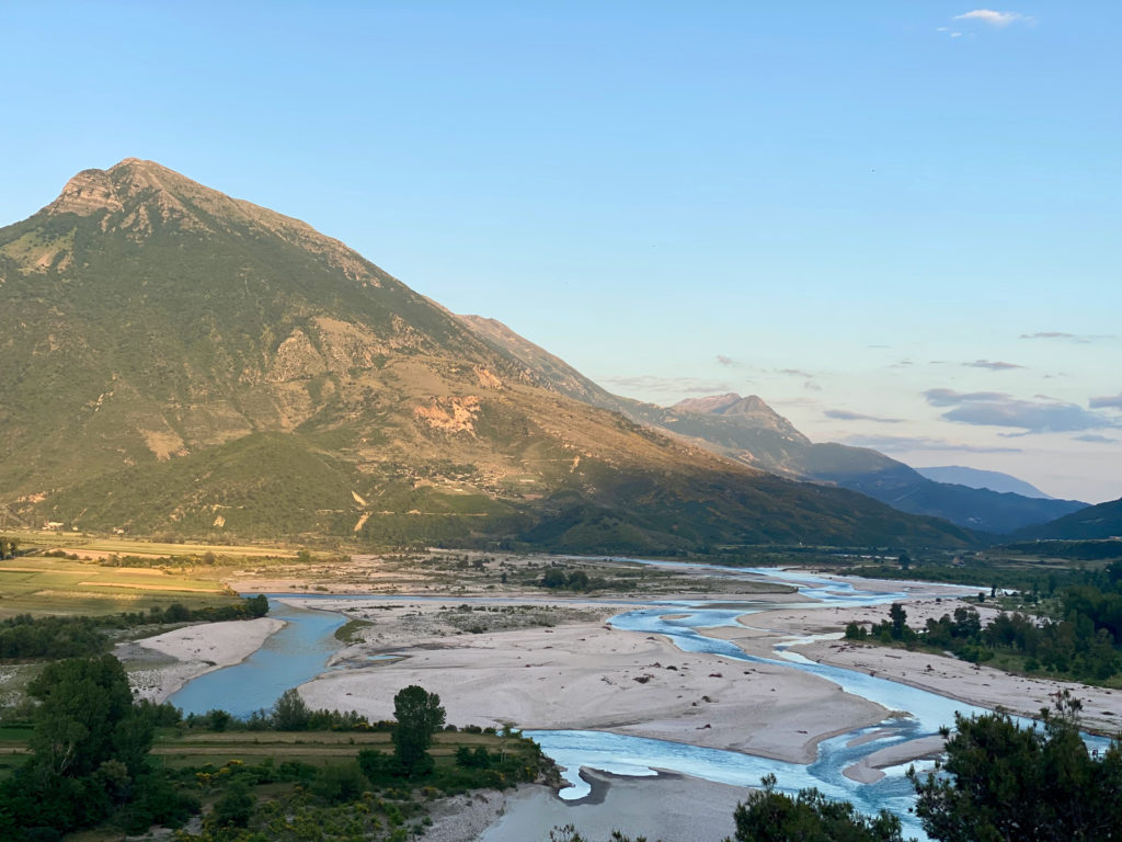
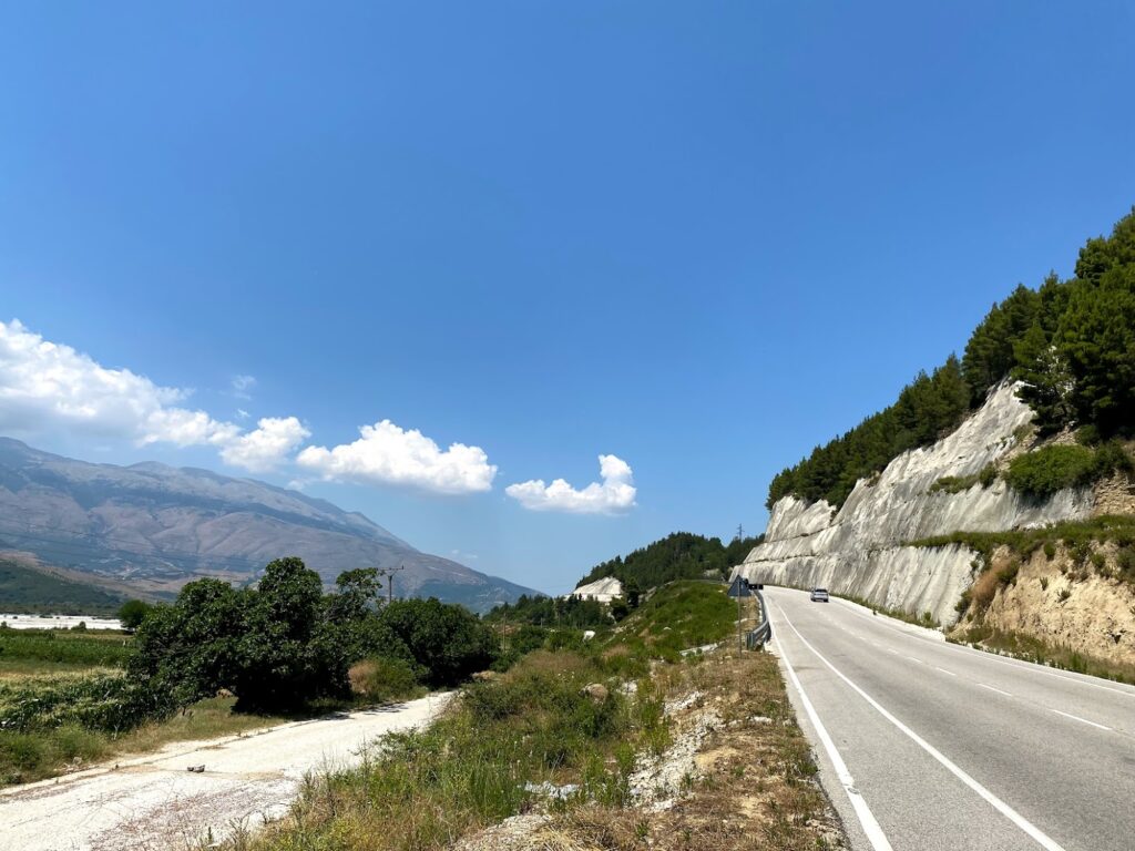
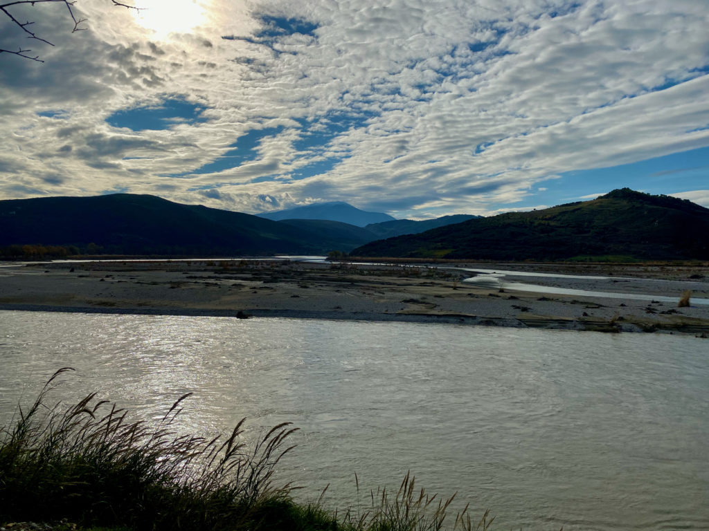
The mid section of Vjosa River has complex river flow patterns with predominantly branched and anastomosed streams. In particular, the area between Tepelena and Kutë village is characterised by very high sediment supply and consequent erosion of its river banks.
The mid section of Vjosa River has complex river flow patterns with predominantly branched and anastomosed streams. In particular, the area between Tepelena and Kutë village is characterised by very high sediment supply and consequent erosion of its river banks.
Throughout history, Vjosa’s dynamic, hydrological nature has always been part of people’s sociality, as well as peoples’ social life has been part of its dynamic nature. Over the centuries people living in the Vjosa valley have gradually adapted to its dynamic nature where the boundaries between the terrestrial and riverine environment continuously shift. Peoples’ relationship to the river have been built through terrestrial practices, such as pastoralism, agricultural activities and associated irrigation canals that link the river with the land. Thus more than about the river, people often talk about their agricultural fields, olive groves, and vineyards located along the irrigation canals where the river and the land meet and connect. They describe the fields that provide food for their families and households, and the annual floods that inundate the fields and houses.
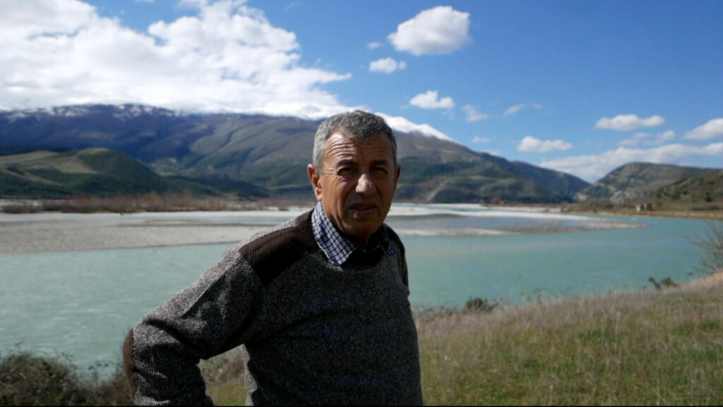
This photo is symbolic and does not refer to the interlocutor described below.
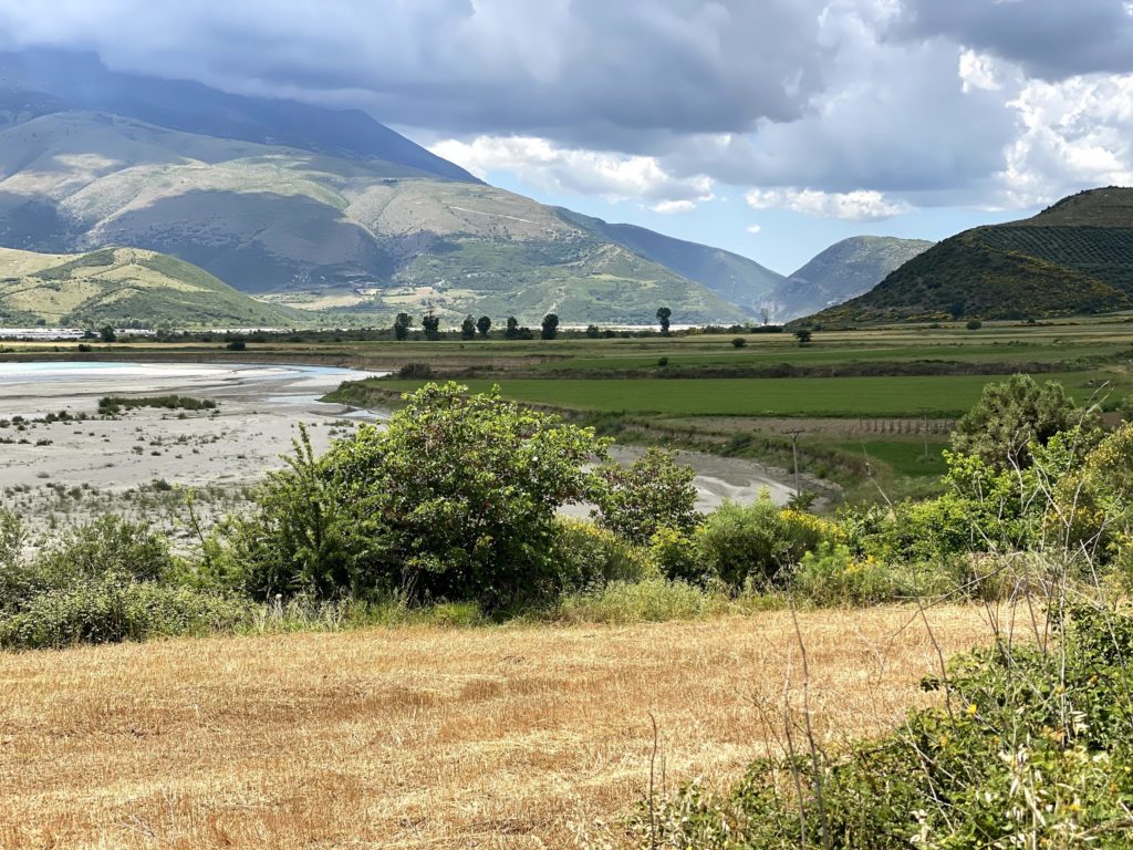
“Down there, the river has eaten up the (agricultural) land”, noted one of the villagers of Iliras, pointing his finger at an area in the distance, right alongside the course of the Vjosa River, where the arable land had been eroded. It was a sunny but relatively windy noon when most of the villagers were working in their fields by the river.
The local from Iliras showed eroded fields in the distance and explained that the river’s course seems to have changed significantly in the last decade, accelerating the erosion of the farmland owned by locals who inhabit the villages scattered in the river valley.
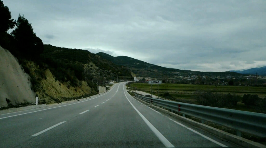
One of these is the village of Illirias, which comprises about 50 houses and is located a kilometre above the agricultural fields on the eastern bank of the Vjosa River.
The local of Iliras went on to say that he also owned some land there, but it had been “eaten up” by the river in the last six years, as had most of the land of the inhabitants of Anevjoses and Qesarat, a neighbouring villages of Ilirias. In contrast to Iliras, which has about 80 inhabitants, Qesarat has about 1300 (according to the 2011 census).
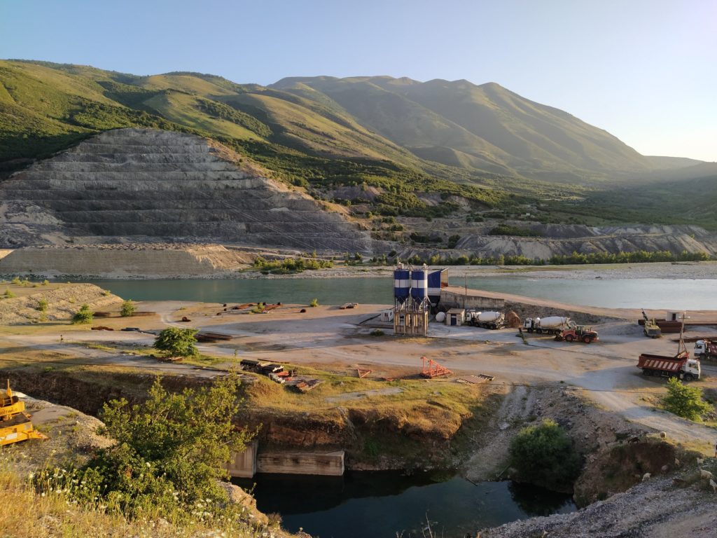
Many villagers of Anëvjoses, Qesarat and Iliras have their land plots located by the river on which they mainly grow corn, wheat, potatoes, beans, and other seasonal vegetables that they consume exclusively for themselves. As the local of Iliras showed his fields, which slope down to the wide gravel banks of the Vjosa River, he explained that because of gravel mining of the Albanian construction company that built a road, these fields are now more often flooded during the winter months than they were in last years. According to many locals, the construction company took the gravel to build the road leading to the Albanian-Greek, border which was completed in 2016 and financially supported by European Union.
According to the villagers of Qesarat and Iliras, the construction company cut down the poplars that lined the course of the river and prevented excessive erosion.
According to the villagers of Qesarat and Iliras, the construction company cut down the poplars that lined the course of the river and prevented excessive erosion.
They explained that, since then, the river course has shifted tremendously, accelerating erosion of the farmland they own. Despite this, many villagers of Iliras, Qesarat and others along the midcourse of the Vjosa River have to pay taxes on land which actually no longer exists. As they explain, 10 dylims (or 1 ha) of land cost 2500 Leks or 20,5 €, which is a relatively large amount considering that most of the local people in this area are unemployed or receive a monthly salary of 200-300 € or pension amounting 100-200 €.
They explained that, since then, the river course has shifted tremendously, accelerating erosion of the farmland they own. Despite this, many villagers of Iliras, Qesarat and others along the midcourse of the Vjosa River have to pay taxes on land which actually no longer exists. As they explain, 10 dylims (or 1 ha) of land cost 2500 Leks or 20,5 €, which is a relatively large amount considering that most of the local people in this area are unemployed or receive a monthly salary of 200-300 € or pension amounting 100-200 €.
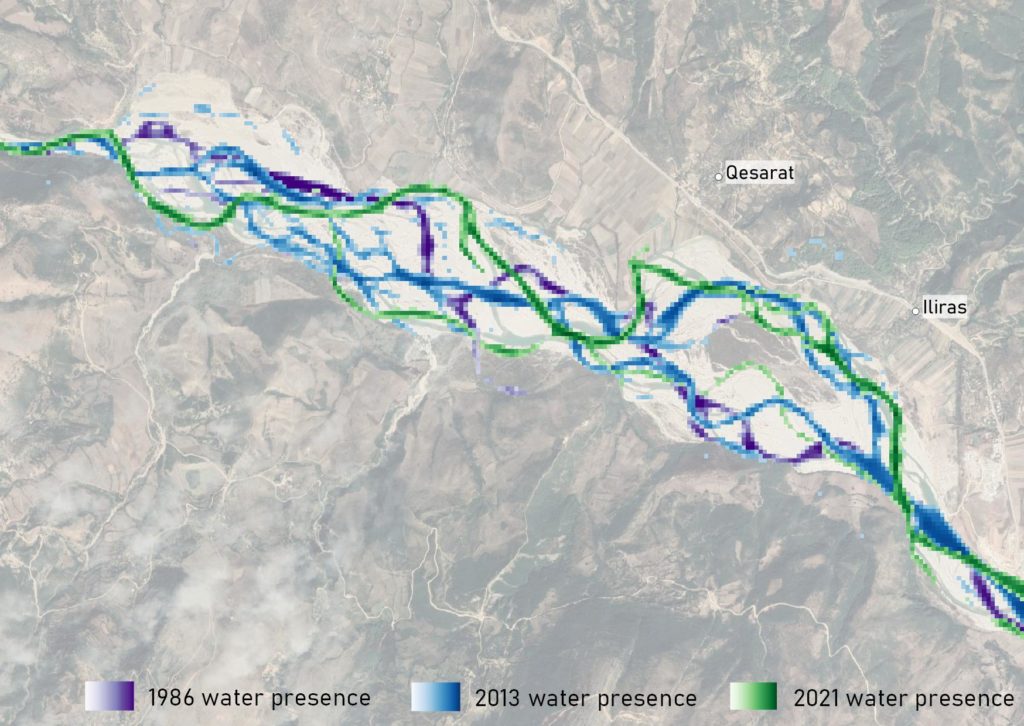
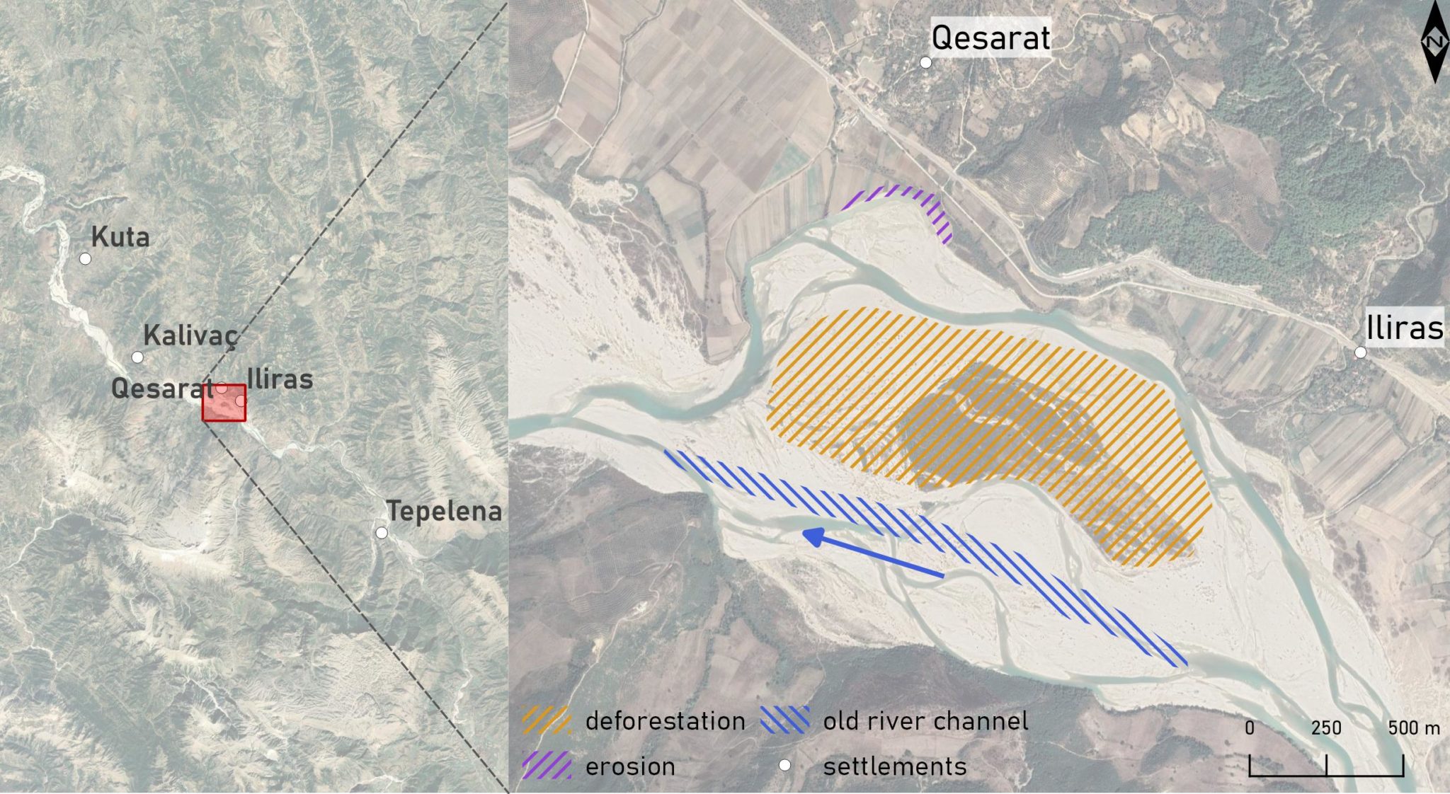
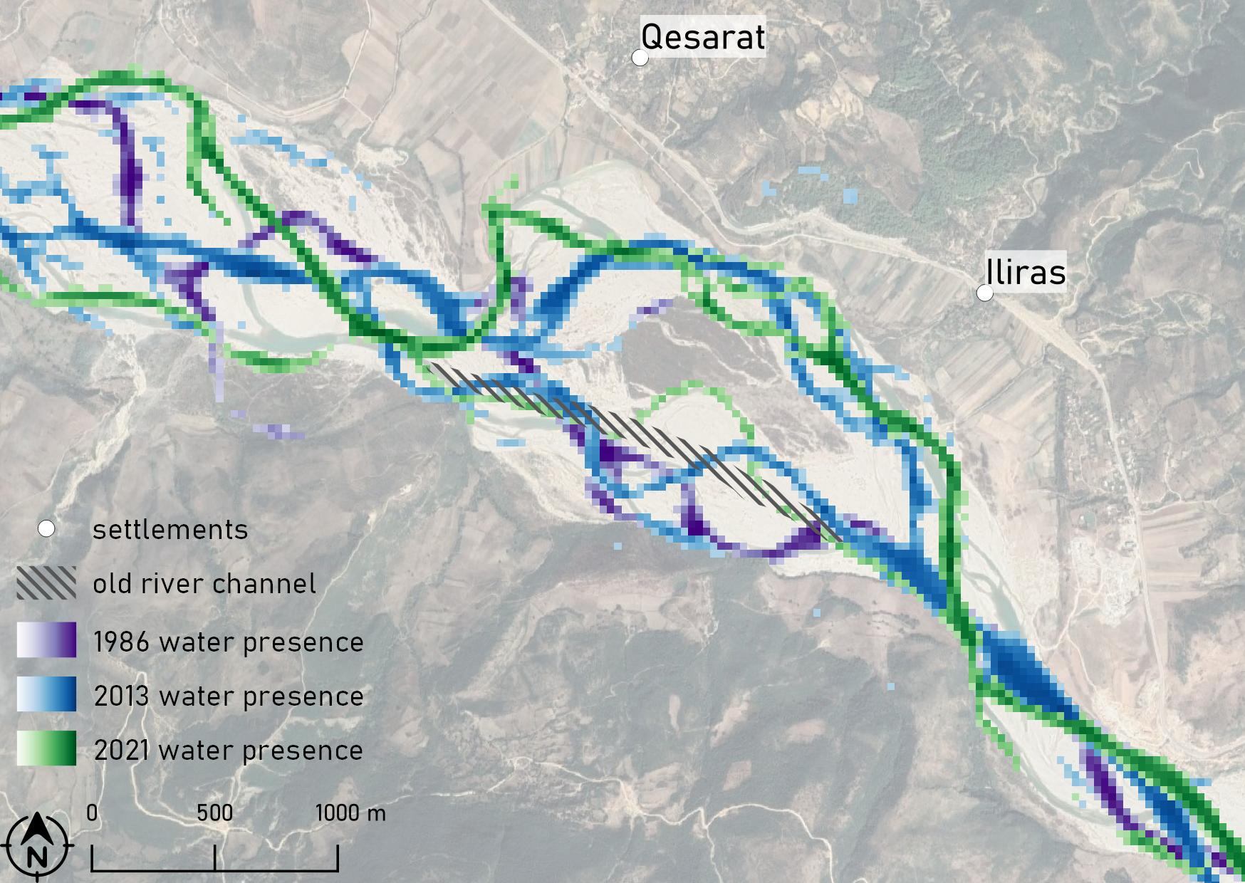
Changes observed by the key informants (interviewees) in the study areas of Qesarat and Iliras. The arrow marks the direction of flow.
The analysis of the semi-open interviews conducted with some of the villagers of Qesarat and Iliras showed that people perceive changes similar to those observed through analysis of the Earth Observation data (EO), which can be seen on the map below.
The villagers ascribed the diversion of the stream more to the right bank of the river, as well as the increasing erosion of the river bank where the agricultural fields are located, to the infrastructural interventions of the past decade.
One of these interventions was gravel extraction for road construction between Kalivaç and the Greek border in 2016 and between Fier and Tepelene in 2010.
One of these interventions was gravel extraction for road construction between Kalivaç and the Greek border in 2016 and between Fier and Tepelene in 2010.
The other is the heavy deforestation that took place after the collapse of the communist regime in 1991. Due to the economic and political crisis that followed, many riverine inhabitants have cut down poplars and other trees for firewood.
The other is the heavy deforestation that took place after the collapse of the communist regime in 1991. Due to the economic and political crisis that followed, many riverine inhabitants have cut down poplars and other trees for firewood.
The third is the construction of the hydropower plant in Kalivaç begun in 1997. Although the construction was stopped at the initiative of the EU Commission and later by the Negative Environmental Statement of the Albanian Ministry of Tourism and Environment in 2021, its partial completion has already brought unexpected ruptures to the daily life of the people of Iliras, Qesarat and many other places along the Vjosa Valley.
The third is the construction of the hydropower plant in Kalivaç begun in 1997. Although the construction was stopped at the initiative of the EU Commission and later by the Negative Environmental Statement of the Albanian Ministry of Tourism and Environment in 2021 and the Memorandum of Agreement between the Ministry of Tourism and Environment and outdoor company Patagonia in 2022, its partial completion has already brought unexpected ruptures (e.g. abrupt erosion of the river banks) to the daily life of the people of Iliras, Qesarat and many other places along the Vjosa Valley.
In Kalivaç, the Albanian-Turkish joint venture Fusha sh. p. k. and the Turkish Ayen Enerji planned to build a 47 m-high dam covering about 1,700 ha of farmland, most of which belongs to the villagers of Anëvjose, Qesarat and Iliras. The 500 m-long dam was to be built on both sides of the hills to form a reservoir with a volume of 350 million m3 and an installed energy capacity of 111 MW.
People living along the Vjosa embody an intimate knowledge of the riverine dynamics which have become part of their daily lives and which they have developed various strategies to address. However, in the last decade, various infrastructural and anthropogenic interventions – as mentioned above – have led to unexpected and remarkable changes in their strategies. These interventions are accelerating the erosion of their agricultural lands, and contributing to excessive flooding of subsequently poor soils and lower productivity. This leads to even greater population migration, which is pertinent in this area since the collapse of the communist regime.