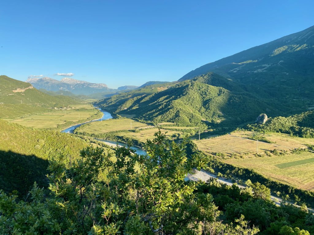
The upstream section of the Vjosa River, extending from the Greek-Albanian border to the Këlcyre Gorge, has relatively few meanders and a shallow but entrenched channel with low gradient and little or no floodplain.
After a few kilometres, the riverbed gradually changes. In the upper section, the Vjosa passes through the small town of Përmet.
After a few kilometres, the riverbed gradually changes. In the upper section, the Vjosa passes through the small town of Përmet.
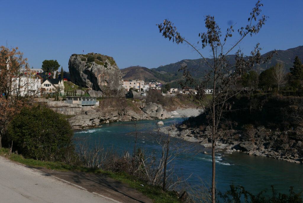
Përmet is known for its “town rock”, a limestone olistolith located near the river.
Përmet is known for its “town rock”, a limestone olistolith located near the river.
According to geologists, this flysch stone, about 15 metres wide and about 25 metres high, is believed to be from the Ionian Tectonic Plate and dates back to the Oligocene.
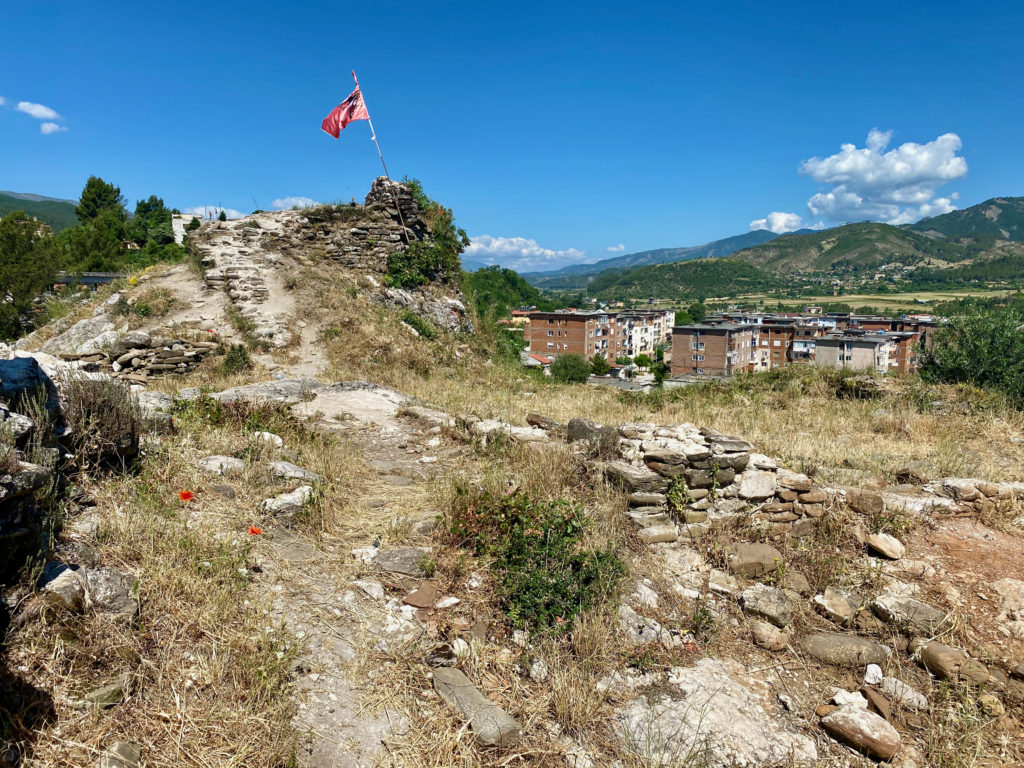
It is believed that the rock was detached from Mount Dhëmbel by an earthquake before the 4th century. On its top there are remains of the fortress dating back to between the 4th and the 6th centuries.
During the Ottoman Empire, Përmet became part of the Sanjak of Gjirokastër and later of the Sanjak of Ioannina (today Greece). During this period, Përmet was a trading town and its population gradually increased.
Despite its proximity to the river, Përmet, like many other towns in the upper and middle basins of the Vjosa, has no fishing and boating tradition due to the relatively shallow river. Fishing was introduced only during the communist regime.
Despite its proximity to the river, Përmet, like many other towns in the upper and middle basins of the Vjosa, has no fishing and boating tradition due to the relatively shallow river. Fishing was introduced only during the communist regime.
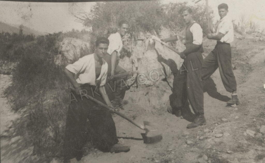
However, the proximity of the river and its rich habitat enabled the locals to develop agriculture and pastoralism which still prevail in the Vjosa Valley. But almost until the beginning of the communist regime (1945), the river dwellers worked on the small plots of land owned by particular patrilines (see Source). With the communist agrarian reform in the 1960s, the agricultural cooperatives were established and the private plots were collectivised. During this period, the workers of the cooperatives, together with the pioneer brigades, made the irrigation canals and many villages in the valley received electricity and water in their households.
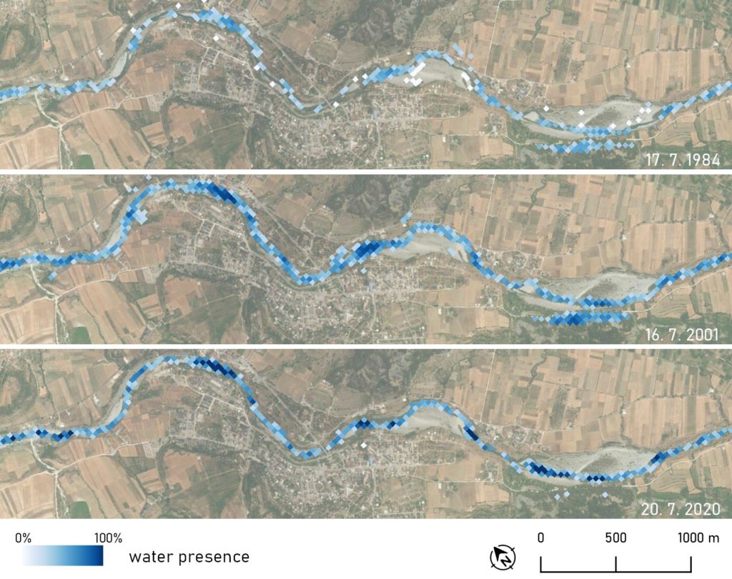
Relatively moderate interventions in the river, before and during the communist regime (1945-1991) have along with the hydromorphological character of its upper course, resulted in minor changes of the river. These minor changes are also detected with the analysis of the Earth Observation data over a period of 40 years.
Relatively moderate interventions in the river, before and during the communist regime (1945-1991) have along with the hydromorphological character of its upper course, resulted in minor changes of the river. These minor changes are also detected with the analysis of the Earth Observation data over a period of 40 years.
In parallel with quantitative remote sensing analysis (Landsat and Sentinel-2 data), a qualitative anthropological study was conducted that questioned how the inhabitants of the Vjosa Valley experience the river and live with and along it. In the course of semi-structured interviews, interlocutors were asked to mark the locations of possible changes on Google satellite maps showing their own location and that of the river basin. Analysis of the ethnographic material revealed that the inhabitants of Përmet do not perceive any significant changes in the riverbed itself or in its surroundings. Thus, qualitative data correspond to the quantitative results of the remote sensing analysis.
Although people in the upper and middle parts of the Vjosa seem to have an indirect relationship with the river, it is of vital importance in their lives. Indeed, through its irrigation canals and rich biohabitat, it provides water for their agricultural fields, their crops, their herds, and the people themselves. But as much as the river gives, it also takes away.
Although people in the upper and middle parts of the Vjosa seem to have an indirect relationship with the river, it is of vital importance in their lives. Indeed, through its irrigation canals and rich biohabitat, it provides water for their agricultural fields, their crops, their herds, and the people themselves. But as much as the river gives, it also takes away.
The elderly residents of Përmet often say that “the Vjosa needs a victim every year because it takes two to three lives”. During the heavy rains in winter, the river can get very high; its current becomes strong and wild, flooding fields and houses, flowing over roads and streets and even carrying away people’s lives and valuables. Later, in summer, it becomes peaceful and calm again, inviting children to swim in its waters, announcing a period of summer joy.
“The Vjosa is our life”, the Përmetaret often say, meaning that it is an inalienable part of their life-worlds and, as such, generates their space-time.
“The Vjosa is our life”, the Përmetaret often say, meaning that it is an inalienable part of their life-worlds and, as such, generates their space-time.
Përmet is a town that plays an important role in Albanian cultural history. It is the birthplace of the three Frashëri brothers, known for their religious, political and literary movements. Abdyl Frashëri was one of the founders and leaders of the League of Prizren in 1878-1881, Naim Frashëri is the author of the first Albanian books and initiator of the first Albanian school in Korce in 1887, while Sami Frashëri is the founder of the Albanian Society in 1879.
Përmet and its surrounding area play an important role in Albanian cultural history. The village of Frashër located near the town of Përmet is the birthplace of the three Frashëri brothers, known for their religious, political and literary movements. Abdyl Frashëri was one of the founders and leaders of the League of Prizren in 1878-1881, Naim Frashëri is the author of the first Albanian books and initiator of the first Albanian school in Korce in 1887, while Sami Frashëri is the founder of the Albanian Society in 1879.
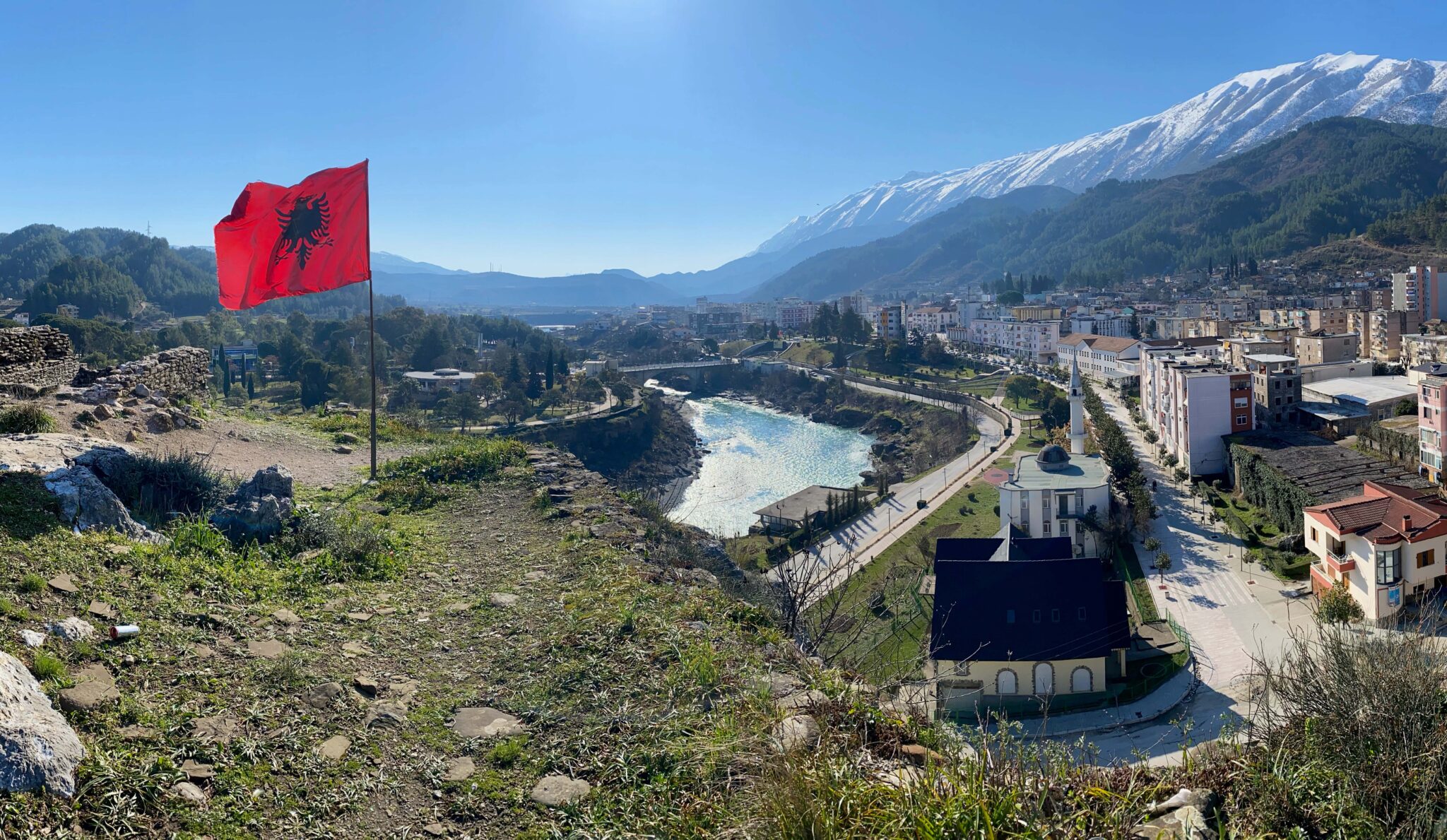
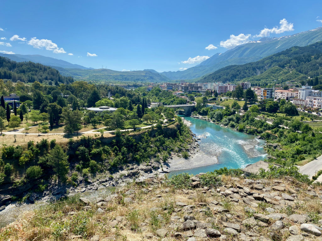
Today, Përmet has about 20,000 inhabitants (Regjistri Civil 2019) and is famous for culinary tourism, herbal medicine (due to its proximity to the Trebeshinë-Dhëmbel-Nemërçkë mountain range) and roses, which is why the city is often called the city of roses – qyteti trandafileve.
Today, Përmet has about 20,000 inhabitants (Regjistri Civil 2019) and is famous for culinary tourism, herbal medicine (due to its proximity to the Trebeshinë-Dhëmbel-Nemërçkë mountain range) and roses, which is why the city is often called the city of roses – qyteti trandafileve.
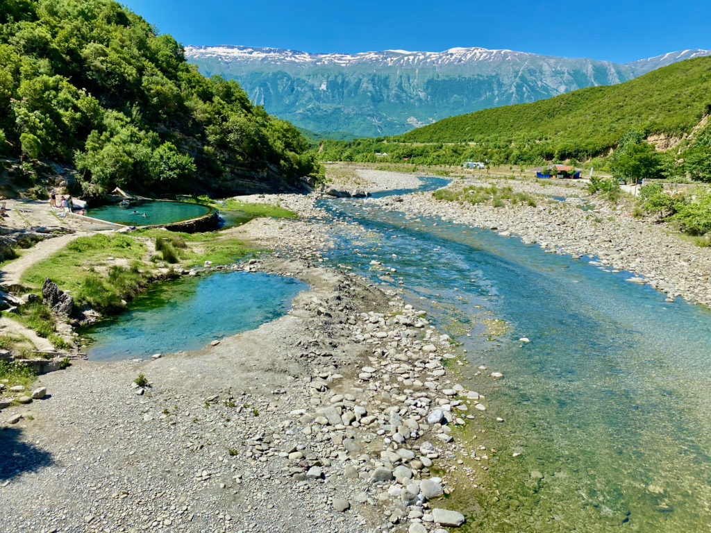
The Bredhi i Hotovës National Park, known for its biodiversity, lies nearby Përmet, as well as the thermal springs of Bënjë, known for their healing tourism. According to the Municipal Department of Tourism, the town has a high potential for sustainable tourism.
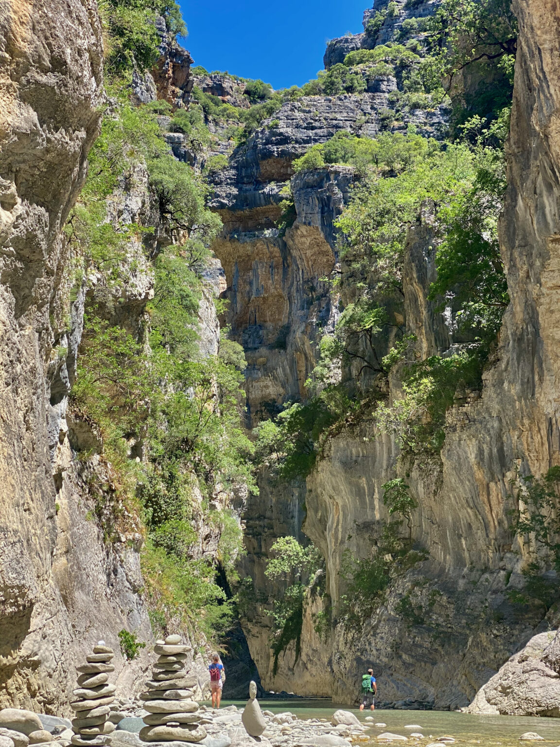
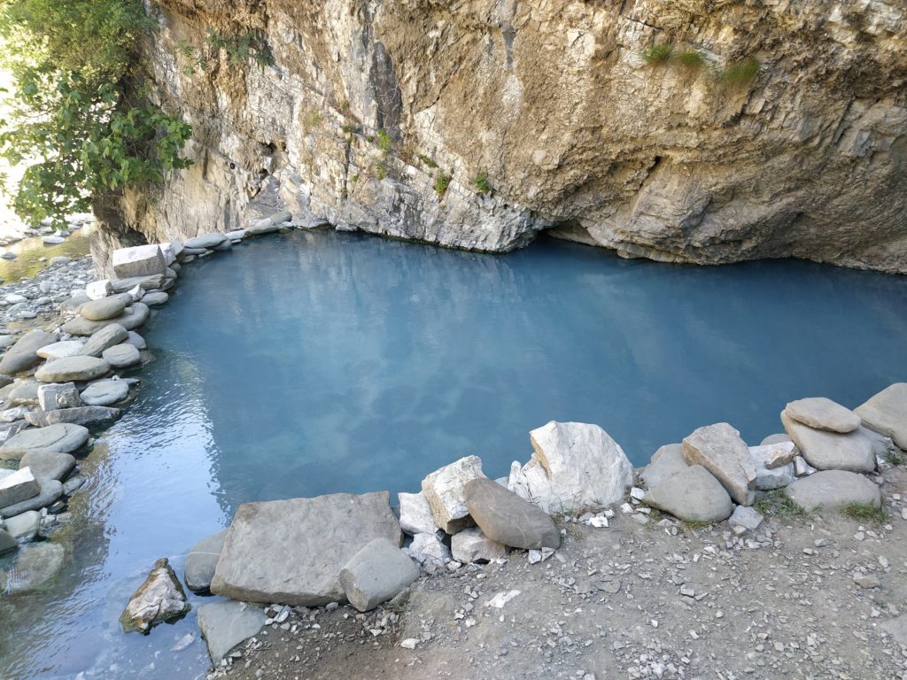
The thermal springs of Bënjë are located at the confluence with the tributary Bënjë, which leads to the vast Langarica Gorge with its thermal springs, offering one of the rare open-air thermal baths in Europe.
But it looks like this will not last long, because since 2015 the tributary Bënça has been bounded by the hydropower dam.
The dam will affect the Langarica Gorge by stopping sediment transport and causing a gradual loss of water in the Bënça tributary. This will also affect the Vjosa River.
The dam will affect the Langarica Gorge by stopping sediment transport and causing a gradual loss of water in the Bënça tributary. This will also affect the Vjosa River.
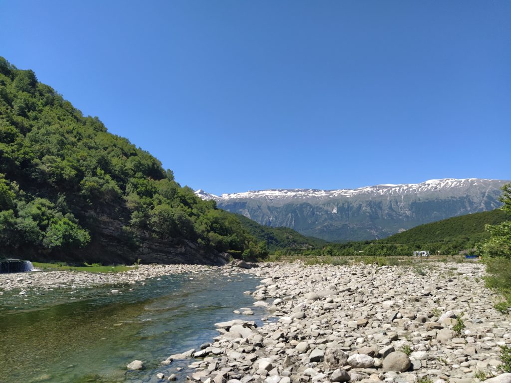
Further south of Përmet, the Vjosa continues its course through the Këlcyre Gorge, where its channel narrows considerably and becomes less meandering due to its hydromorphological characteristics.
Further south of Përmet, the Vjosa continues its course through the Këlcyre Gorge, where its channel narrows considerably and becomes less meandering due to its hydromorphological characteristics.