The first hydro-technical measures on the Mura River were carried out 210 years ago when a meander was cut by a moat on the Cven–Razkrižje section. Due to regulations in the last century and a half (1870–2020), the exposed sections of the higher gradient led to processes that deepened the main riverbed and reduced groundwater levels in the area of river branches and inundations, with the concomitant appearance of oxbow lakes and their gradual draining. Meanwhile, human activity has been heavily increased through the processes of land reclamation and land consolidation to maximise the gain from the arable land at the expense of the former riverine environment. The biggest changes are noticeable on the Apače plain, where the oldest long-term regulation took place more than 130 years ago. The regulation in this area (near Črnci) narrowed the river area by 15 times (from 1,200 meters to about 80 meters), and at Obrajna by 9.5 times (1,900 meters to 200 meters). Distances vary according to the width of the riverbed and the position of the main arms.
The regulation not only increased horizontal surface drainage and denudation, but also significantly changed the regime of groundwater fluctuations and thus changed the volume, quality and flow of groundwater. The Prlekija side of the Mura River was more affected than the Prekmurje side. Fluctuations in groundwater levels previously mitigated the spillage of water into river branches, canals and floodplains, but regulations radically accelerated the speed of water, which overcame the same height difference over a shorter distance. The picture below shows the Petanjci natural springs of thermal and mineral water in the area of faults and cracks between geological layers – the so-called zone of rustling and bubbling – where the riverbed is significantly beneath the river bank.
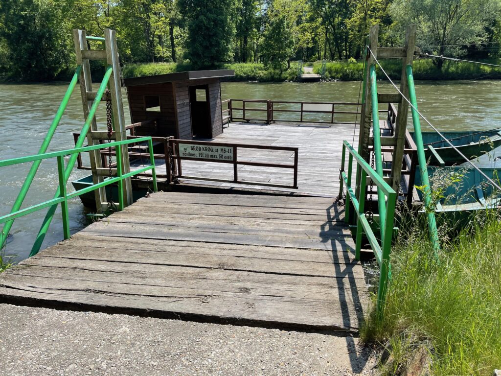
Deepening of the riverbed is a product of both regulation, which has increased speed of the water in river, and the establishment of many hydropower plants in Austria, which have the amplified highs and lows of flows and thus increased extremes. The mechanism that is deepening the riverbed after the Mura enters the Ravensko plain is an element of erosion processes which include core stream reinforcement and deep gravel erosion. Acceleration of water velocity and flows results in faster entry of water into the lower stream of the lower gradient, which increases the accumulation of water and transported material. The consequences of riverbank erosion and riverbed deepening are visible to the naked eye and are also felt in shipping activities. For example, the ford on the Mura near Krog is already well below the access ramp.
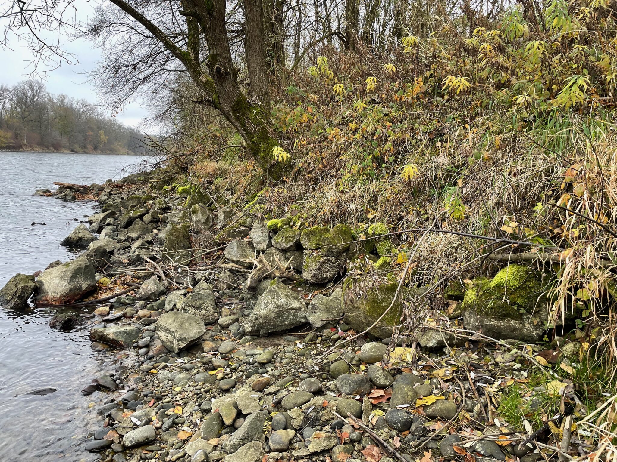
Based on changes in the speed and flow of water, eroded material accumulates in the unregulated part (lower Mura border section) under the inner banks of the meanders. This is no longer replaced by freshly eroded material from the upper stream in Austria, where it is retained by the dams of some thirty operating hydropower plants. Therefore, the recent downstream gravel is a distinct result of the lowering of the riverbed. The accumulation sites have moved some 70 km downstream, while the once fortified banks (büjri) are geting lost due to deepening. Büjranje is a Prekmurje term for digging a riverbed into embankments, and the büjraši were the fortifiers of the banks. Today, the fortification of the banks is problematic and many embankments, especially in the lower reaches of the Mura, are not regularly maintained.
In the following short film, Mr. Viktor Bogdan describes how the landscape around Hotiza used to look when the part of the Mura was not regulated, and explains how he sees the consequences of the regulation of the Mura. He playfully mentions that due to the effects of regulation and the resulting faster flow, “the Mura is licking its sink”, thus its riverbed is getting deeper, the groundwater level is lowering and there have been no major floods recently (also due to climate change and intensive agricultural use of the water).
The deterioration of fortified banks due to the low water level threatens the defensive embankments which prevent the river from overflowing into old channels, but these measures have also reduced the groundwater level. The picture shows Murometer – an excavated pit that was used to observe the fluctuations of groundwater.
The regulation of the riverbed increased the areas for agricultural use, as the embankments prevented floods, yet those along the Mura River are not regularly maintained. During the floods of September 2014, the Mura River flooded heavily and in many places the embankments did not hold up, although the river flooded mostly outside the flood defences. The Mura River had then the highest discharge ever measured at the Gornja Radgona gauging station, namely, 1327 m3/s.
The floods caused not only the high water level of Mura, but also raised the level of groundwater so that it could not absorb excess water from the Mura, thus aggravating the flooding. The floods reached all the way to Mostje at the Hungarian border.
On the Austrian side of the Mura border, the hydrotechnical company deliberately demolished fortified banks in several places and extended the river into old branches or canals. The goal is to try and reduce the speed of the river and allow the water to withdraw from the banks and return some of the eroded gravel to the riverbed. However, this will not be enough in the long run, as an unhindered and constant supply of gravel is needed to stop the deepening. To achieve that, reconstruction of the enclosing dams along the whole upper stream is needed to ensure sufficient gravel passage by the dams. On the Slovenian side, a single such measure was taken at Segovci in the Apače field, but it is not clear whether it has contributed to the reduction of deepening.
The primary cause of the geomorphological changes of the last 150 years is human activity. An important turning point in the field of energy use of the river and its tributaries is the period of innovative construction of river mills, especially for the needs of sawmills and grain milling (1820-1850). Their abolition in later years was also affected by regulation and not only by electrification and modernisation of production.
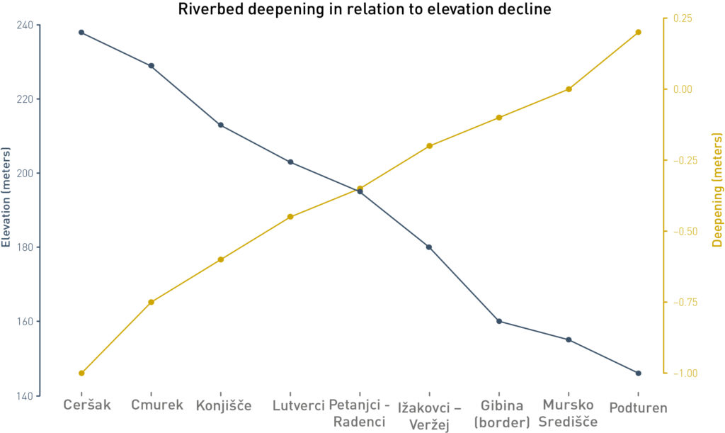
Measurements in the period 1974 – 2012 confirm the perceived picture of visible deepening. A more detailed analysis showed that the deepening is most intense in the area of the upper border section of the Mura. In the inner section of the Mura’s course through Slovenia, the deepening decreases, while in the lower border section there is a marked accumulation and long-term increase in changes in gravel areas, which is in full correlation with the section of the regulated riverbed.
The deepening continues: from 1.2 metres near Črnci, up to 2 metres at Cmurek and Ceršak, according to the latest estimates. In some places there is only 20 cm of riverbed left above the parent granite rock, meaning that in the future, the migratory routes of fish and other river life will be interrupted. This, in turn, would have wider negative environmental consequences. A key mistake in interfering with the flow of the Mura River was made in the second phase of regulation (Middle Mura), which has accelerated deepening over the past 50 years. Previously no measurements of deepening were performed, so the regulation of the border section seemed to work in an orderly manner. However, the shortening of the Mura on this section by 4 km markedly increased the slope gradient (to 1.28 metres per km).
The deepening intensified after the beginning of the construction of the HPP on the Austrian part of the Mura, and was accelerated by the regulation of the Inner Mura between Petanjci and Gibina.
In addition to the deepening due to riverbed erosion, the level of water is also decreasing. This can be observed on a time series of hydrological data from gauging stations.