The Mura (German: Mur; Slovenian/Croatian/Hungarian: Mura; Prekmurje dialect: Müra, Möra) is a typical alpine river which has its origin in the central crystalline Alps of Austria, rising in the Hohe Tauern National Park in the province of Salzburg and flowing into the Drava River near Legrad (Koprivnica-Križevci County) in Croatia. The Mura River is 465 km long in its entirety.
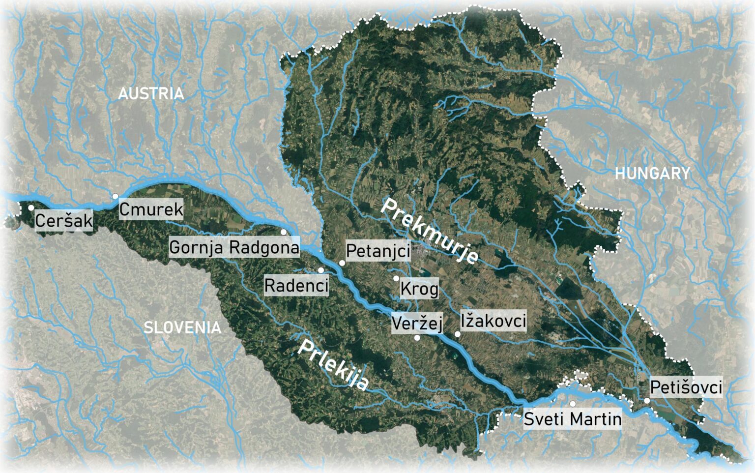
Historically, most of the Mura River that flows through present-day Slovenia was part of the Panonian principality; only the westernmost part near Ceršak belonged to Carantania, a Slavic principality. The border between the two was somewhere near the present-day village of Cmurek. Later, in 1919, the Mura River (between Ceršak and Gornja Radgona) became the border between the Kingdom of Serbs, Croats and Slovenes, and German Austria. Today it flows through Slovenia for a total length of 95 km, with the section of the Slovenian “inner” Mura being about 33 km long and the rest forming a border with Austria and Croatia.
The ancient technology of floating mills powered by the river current was adopted on the Mura by the incoming Slavs and later by the Magyars. A military map of the Austro-Hungarian Empire shows that there were 69 floating mills on the Mura from Krog to Sveti Martin (Croatian border). Today, only a few of these mills are still in operation, the most famous being the Babič mill near Veržej, Slovenia.
Mills need to be properly maintained and rehabilitated, as rising rivers during storms can damage the drive wheels of mills due to increased water and floating trees.
It is known that the Mura contains small amounts of gold, not enough to be suitable for exploitation today, but this has been a focus of activity for many people since ancient times. Organised exploration for gold and other local resources was first promoted in 1772.
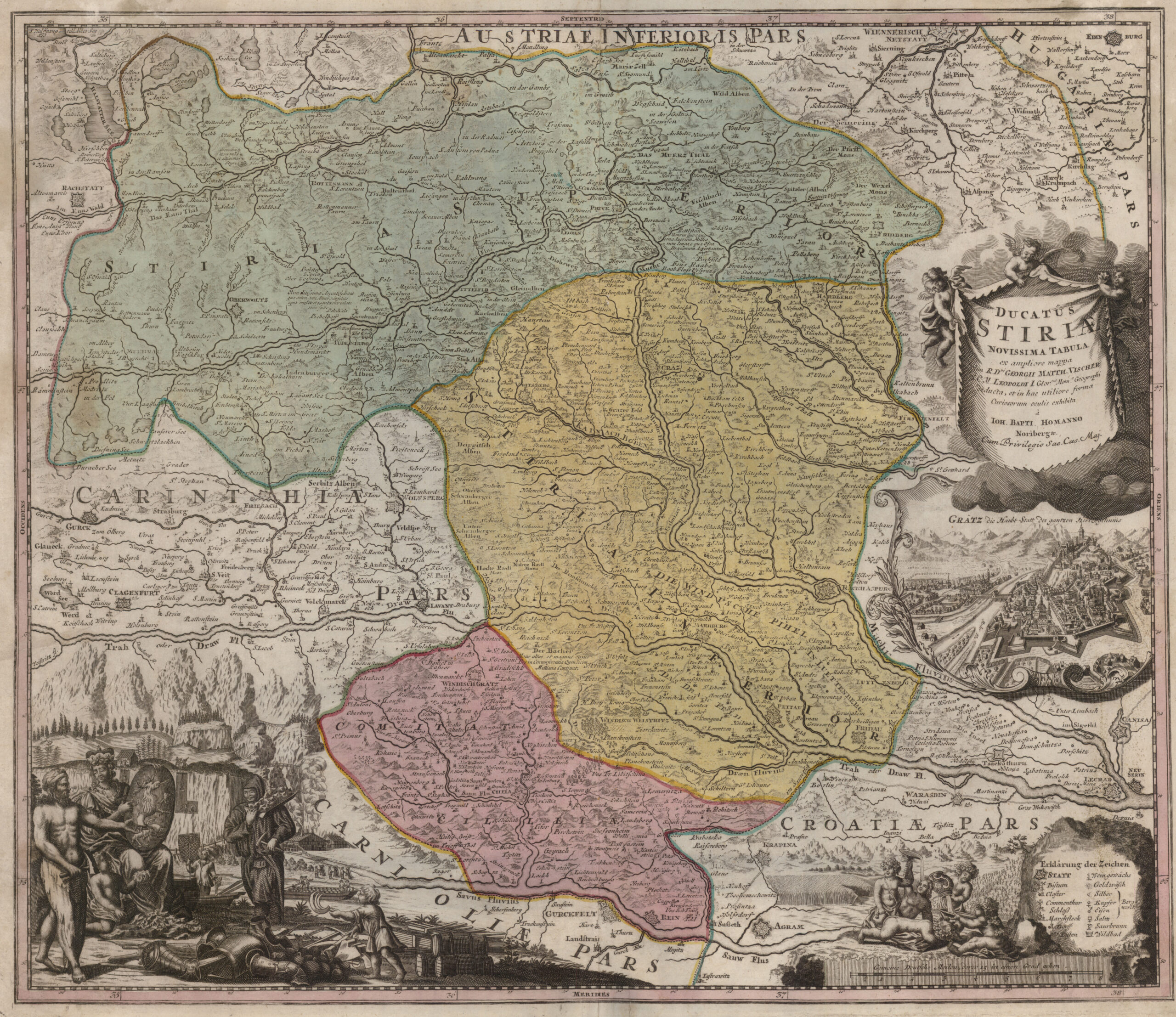
An old coloured map of Styria by Johann Baptist Homann shows the area around the Drau and Mura rivers. Mura river is shown on the upper half of the map.
Map: Ducatus Stiriae Novissima Tabula; Johann Baptist Homann; around 1720
Source: Digitalna knjižnjica Slovenije (dLib.si)
Historically and cartographically, one can trace the changes in the riverbed of the Mura from the 16th century. In the past 500 years, the main stream and its branches have repeatedly and significantly changed position and course. This can be observed in great detail through cartographic comparison and layer-by-layer mapping.
There are several periods of development of techniques and cartographic representations for this particular area:
– from approx. 1500 onwards: panoramic displays on wall paintings
– 1678: publication of Vischer’s maps
– 1714: Ducatus Stiriae novissima tabula map by J. B. Homann
– 1763-1787: first military (Josephine) survey
– 1806-1869: second military survey with the implementation of the Franciscan Cadastre (1824-1860)
– 1869-1887: third military survey
– 1890-1925: the first modern special maps for the whole of the Austro-Hungarian Empire, issued after the break-up of the Danubian Empire; also published in the Kingdom of Serbs, Croats and Slovenes (SHS)
– from 1970 on: cyclical aerial photogrammetric measurements of Slovenia
– from 1972 on: availability of optical satellite imagery
The meanders of the Mura through today’s Slovenia (now strongly regulated) are clearly visible on this map from the end of the 19th century.
Map: Specialkarteder österreichisch-ungarischen Monarchie, year 1890
Kept by: Geographical Museum GIAM ZRC SAZU
Land tenure and field division in Prekmurje and Prlekija
The history of the territorial affiliation of Prlekija to the Austrian internal order, and Prekmurje and Medjimurje to Hungary, led to a drastic difference in the structure of land-parcel division and land-ownership.
Prlekija, as part of the Styrian Duchy, was characterised by viticulture, rental farming, and landless agricultural producers. Land ownership remained the property of the feudal lords up until the end of WWI, when feudal ownership was finally abolished by agrarian reform in the Kingdom of Serbs, Croats and Slovenes. After the agrarian reform the feudal land was by and large divided among the peasants, the former serfs. The partial collectivisation of agricultural production in the form of Agricultural Combines (Slovenian: Kmetijski kombinat) resulted in a larger share of consolidated land.
On the other side of the river, Prekmurje was part of the historical Hungarian branch of the Twin Monarchy, where the old Roman law was re-established after the collapse of Ottoman rule in the late 1690s. The land was allocated to villagers to secure their economic welfare. In comparison with Prlekija, the Prekmurje peasants historically retained the right to own land and to keep it for their offspring. The consequences of modernisation in the mid-19th century enabled a doubling of the population in less than a half a century, resulting in a division of the land among many descendants. The process of fragmenting the land parcels was so pronounced that the major part of the land was scattered among tens of thousands of local owners, who became poorer as a result. This also contributed to the first modern migration waves that began in Prekmurje at the end of 19th century. Overall, land later remained predominantly privately owned with only the former feudal land being nationalised for state-owned agricultural production.
Regulatory phases on the River Mura
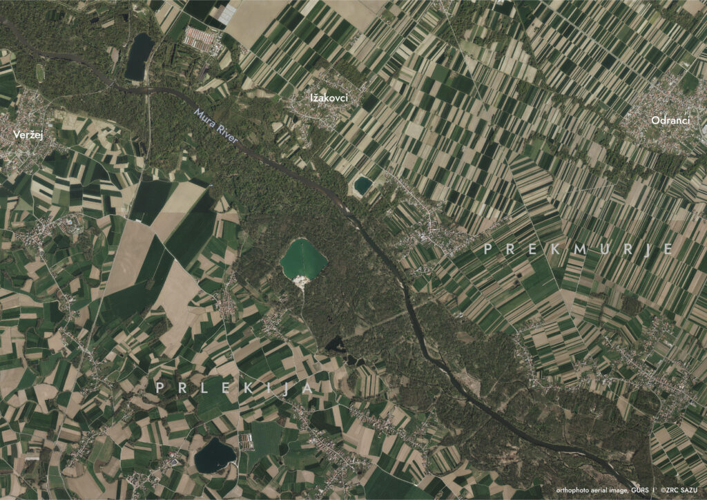
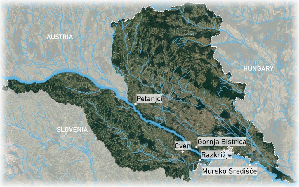
Some sections of the Mura’s course were regulated as early as the 18th and 19th centuries. The greatest influence on the change of the course of the Mura River was the “Hochenburg regulation”, which took place mainly at the end of the 19th century and was planned on the section Gradec-Cven (near Ljutomer). Maps of the military survey from the period 1869-1887 show that the regulation was carried out up to the then border section of the Mura between the Hungarian and Austrian halves of the monarchy. The border section Petanjci – Cven remained unregulated, mainly due to the Hungarian practice of not matching the river borders with the cadastre. After 1920, the new regulation was carried out on the Petanjci-Gornja Bistrica section and after 1945 on the Gornja Bistrica-Razkrižje-Mursko Središče section.
The former inundations (the “oxbows”) have begun to dry up and become overgrown at an accelerated rate as a result of river regulation. Visualisation using a digital elevation model (DEM) of the terrain in the “inner” Slovenian Mura area clearly shows us the remains of the old river meanders.
References:
– Šeško, Anton. 1974. »1888-1973. Petinosemdeset let tovarne lepenke Ceršak« Izdala: Tovarna lesovine in lepenke Ceršak, ob 85-letnici tovarne, ZGP Pomurski Tisk